P R O J E C T
Sensing Landscapes
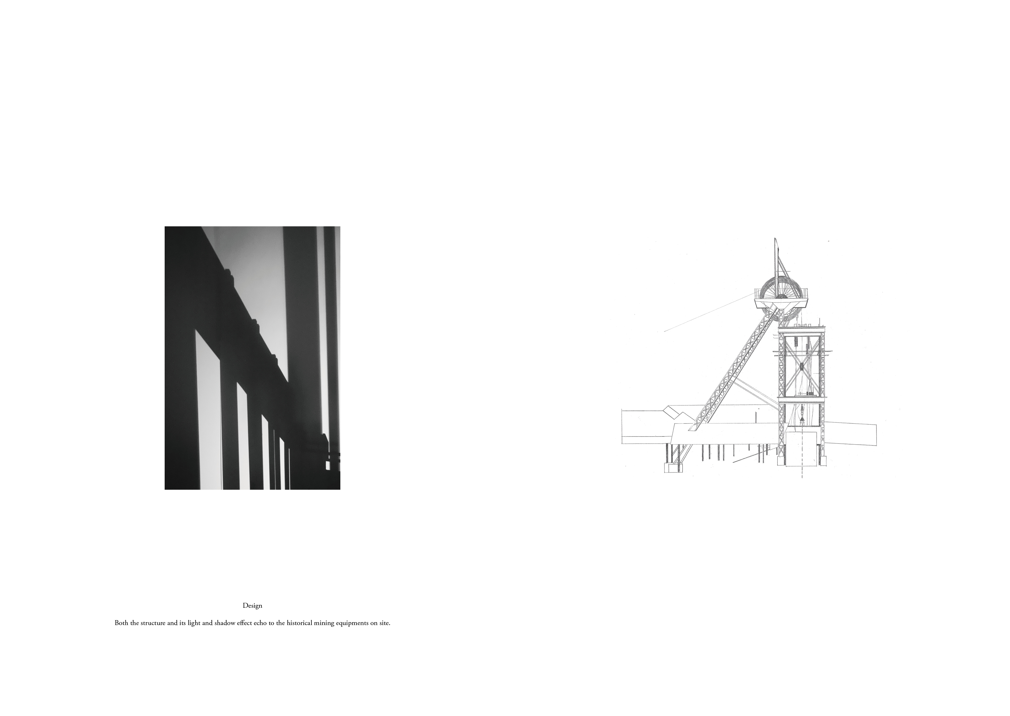
Temporary interventions can leave people with a lifelong awareness of nature, both beauty and cruelty.
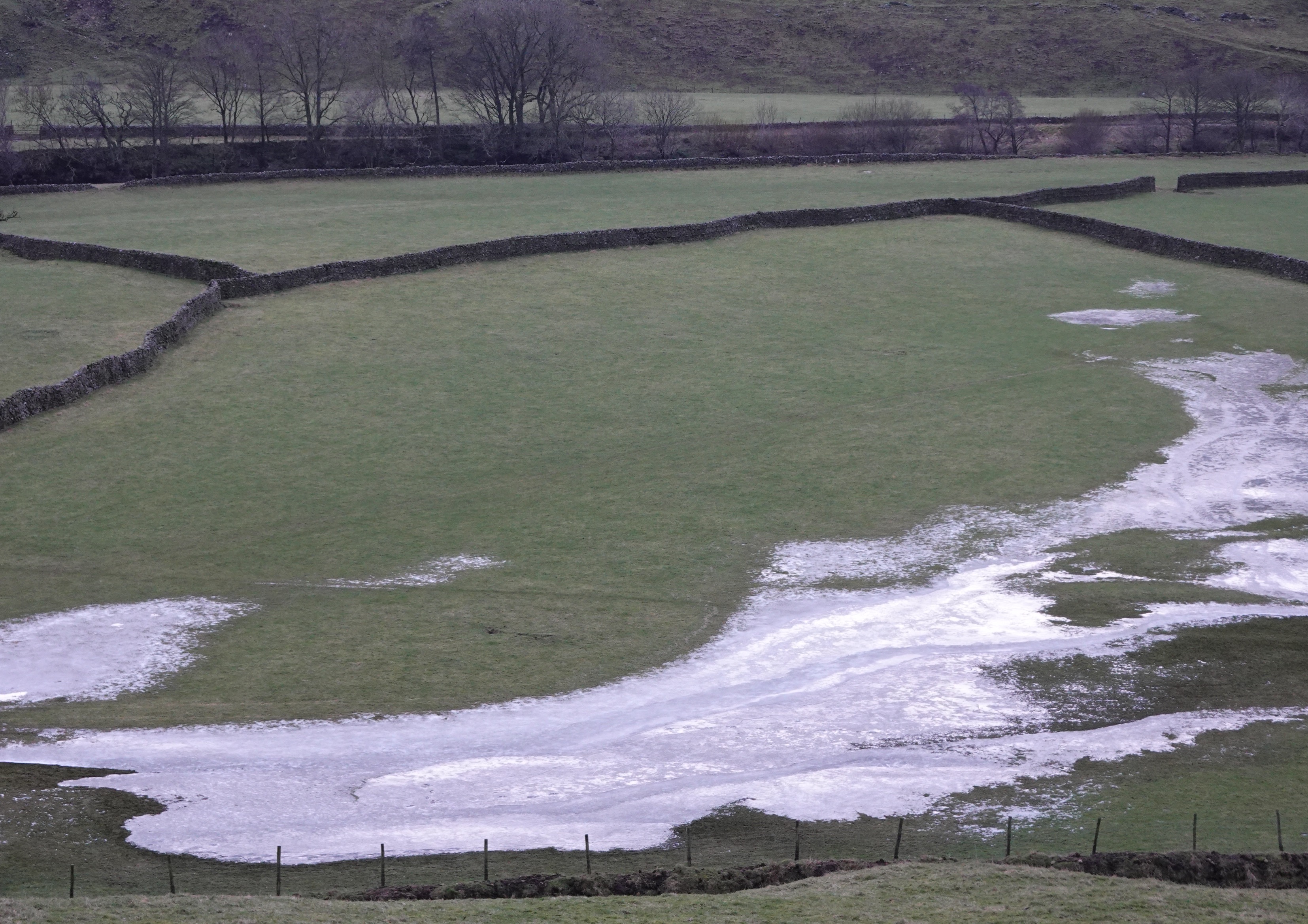
Located in Yorkshire Dales National Park, the project consists of a series of interventions, spreading along the River Swale to observe the shifting landscape — severe flooding issues, eroding banks, and crumbling buildings, and as an educational strategy to make people aware of nature. Rather than avoiding water, it is utilised as a connecting material to encircle the systematic interventions. Using perception as another way to touch and prevent the landscape, the project aims to mobilise people’s senses to see, hear and become aware of nature through different space designs.
Three sites are picked and tested for applying specific interventions to sense the landscapes: recording flooding, transferring water’s kinetic energy into its mechanical movement; framing neglected mining heritages, decaying as one part of the landscape; zooming into bank erosion underfoot, and amplifying water sounds.
The river runs along the middle part of the famous Coast to Coast hiking route, which is seasonal and not well-facilitated, bringing risks for hiking. Hence, the project also intends to provide hikers with resting spots.
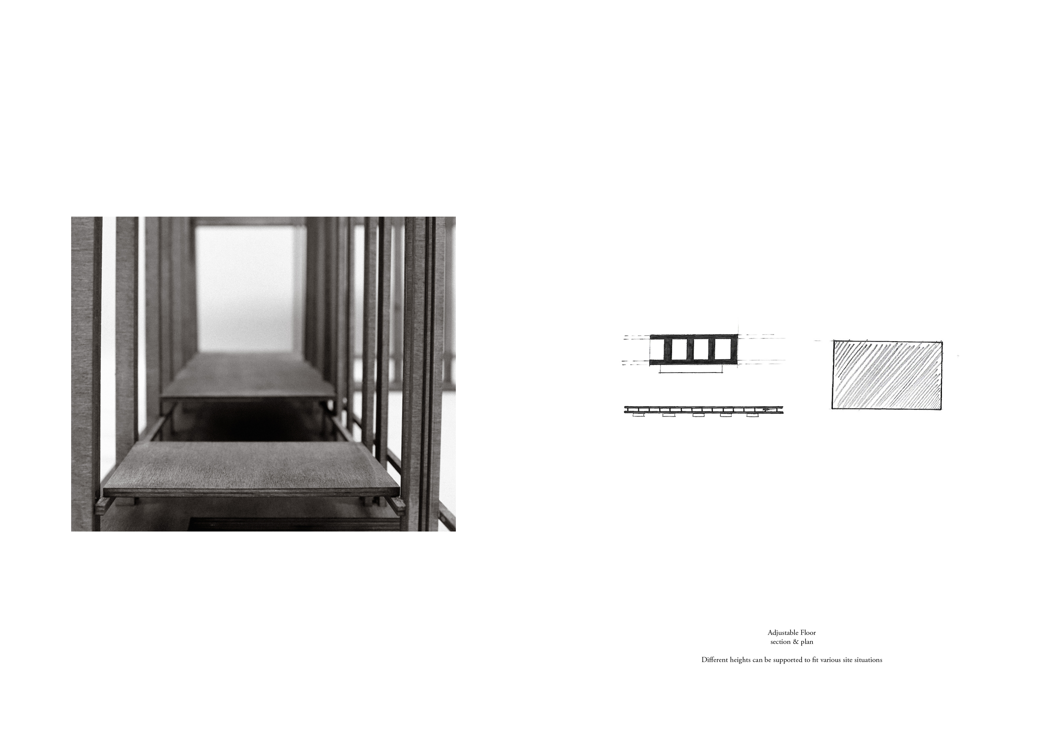
As a system, they can be easily constructed, deconstructed and moved to different spots along the river, adapting and sensing multiple land conditions by applying flexible structures and various interlocks with sites.
#1 Site _ River / Hiking
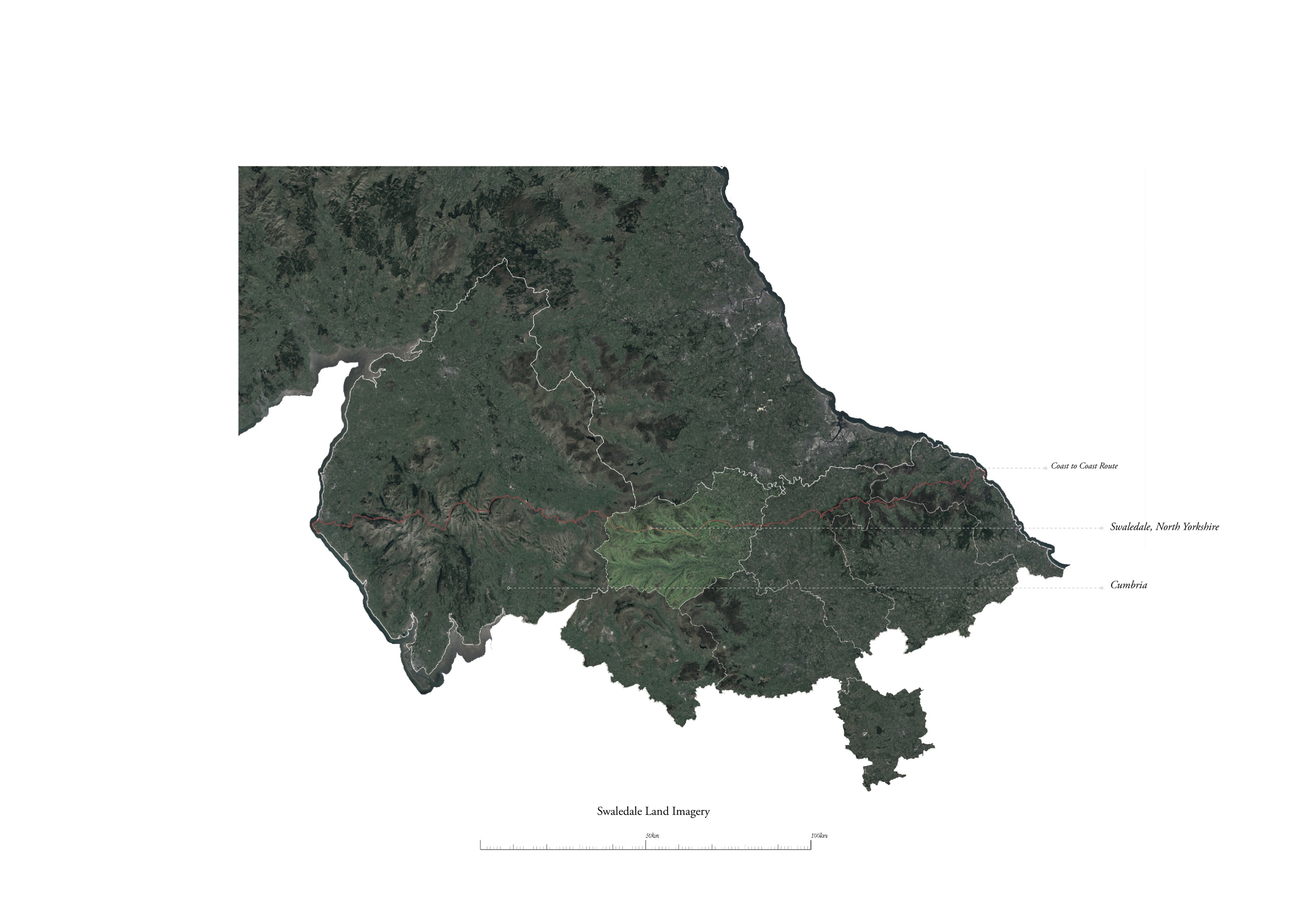
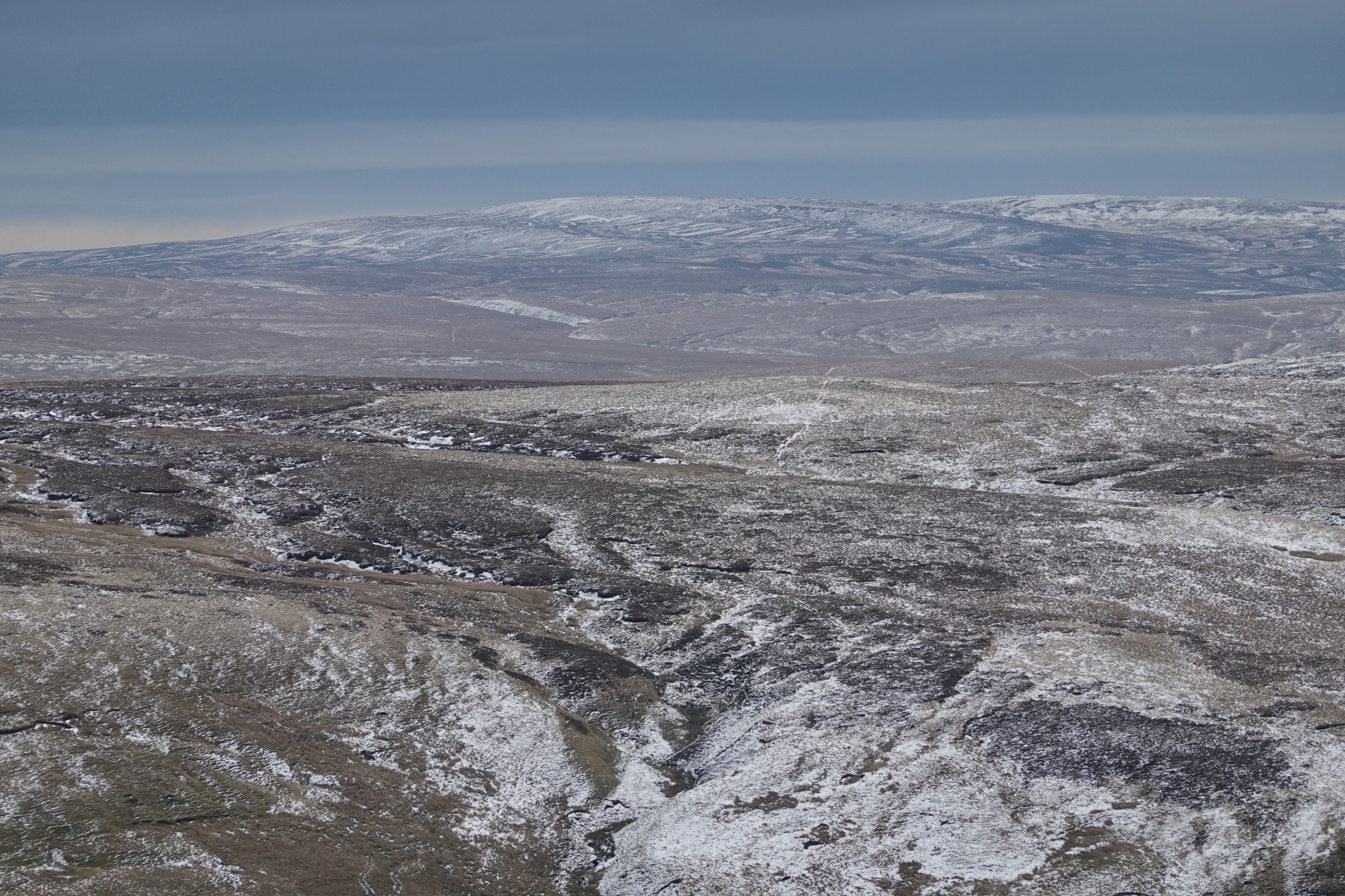
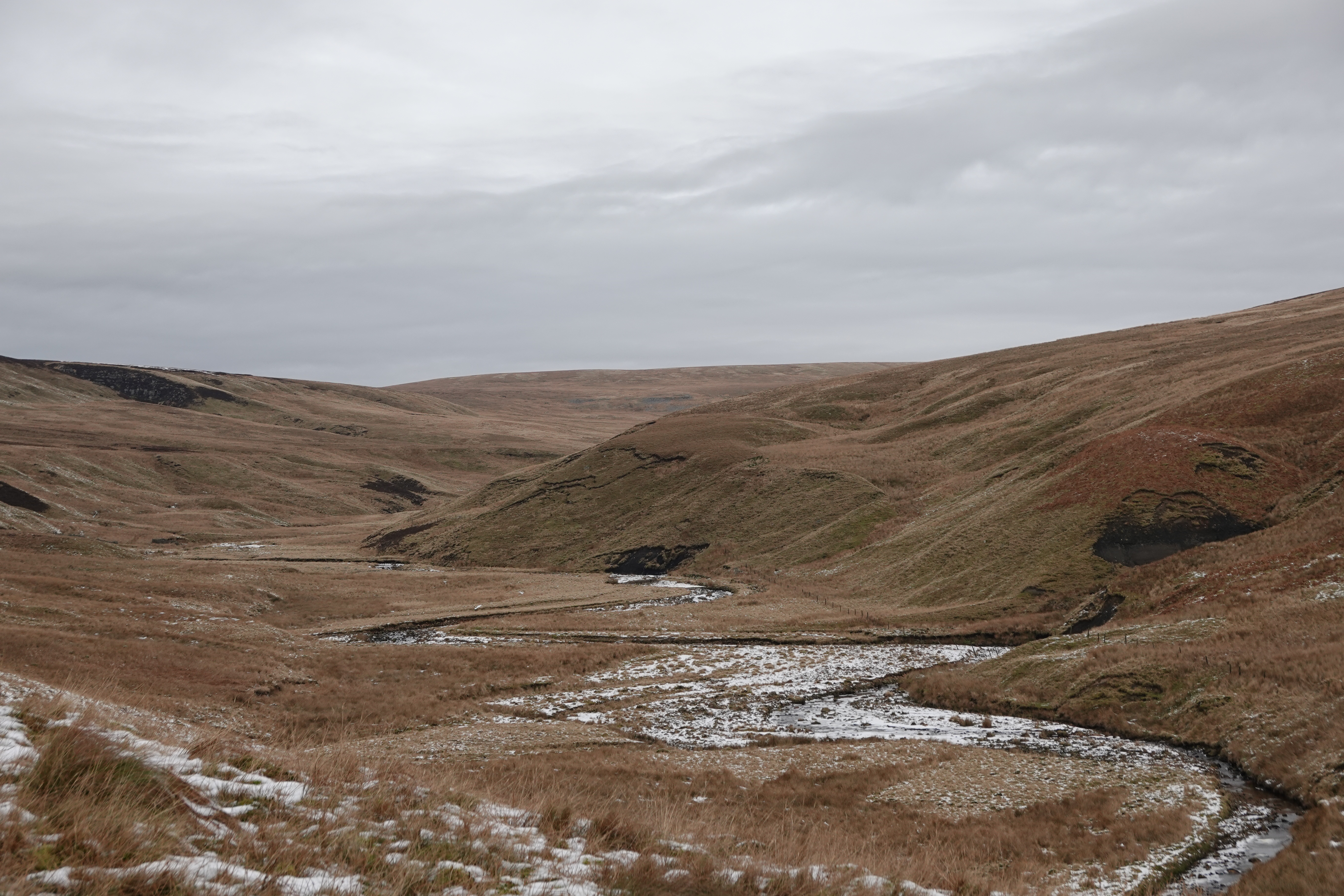
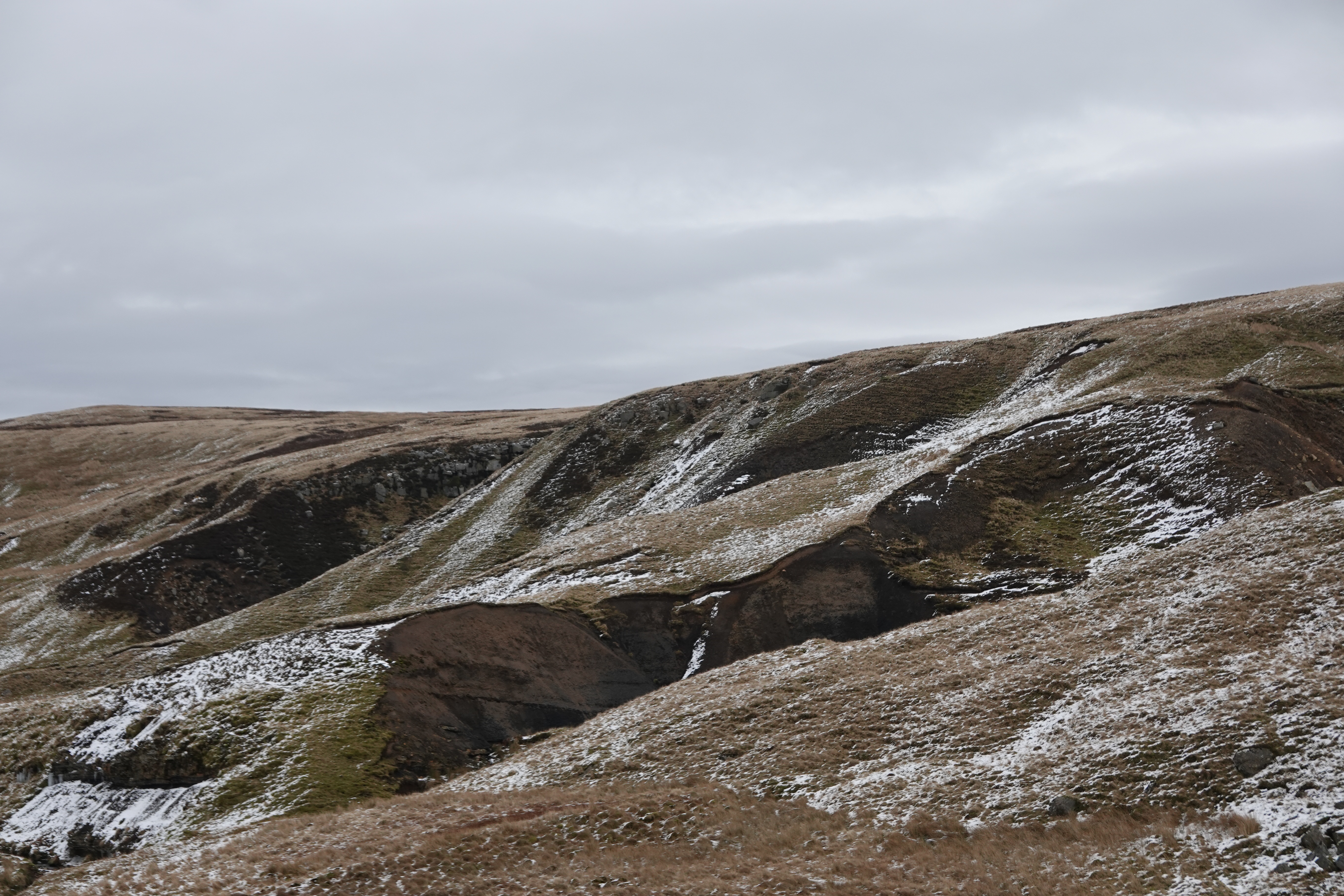
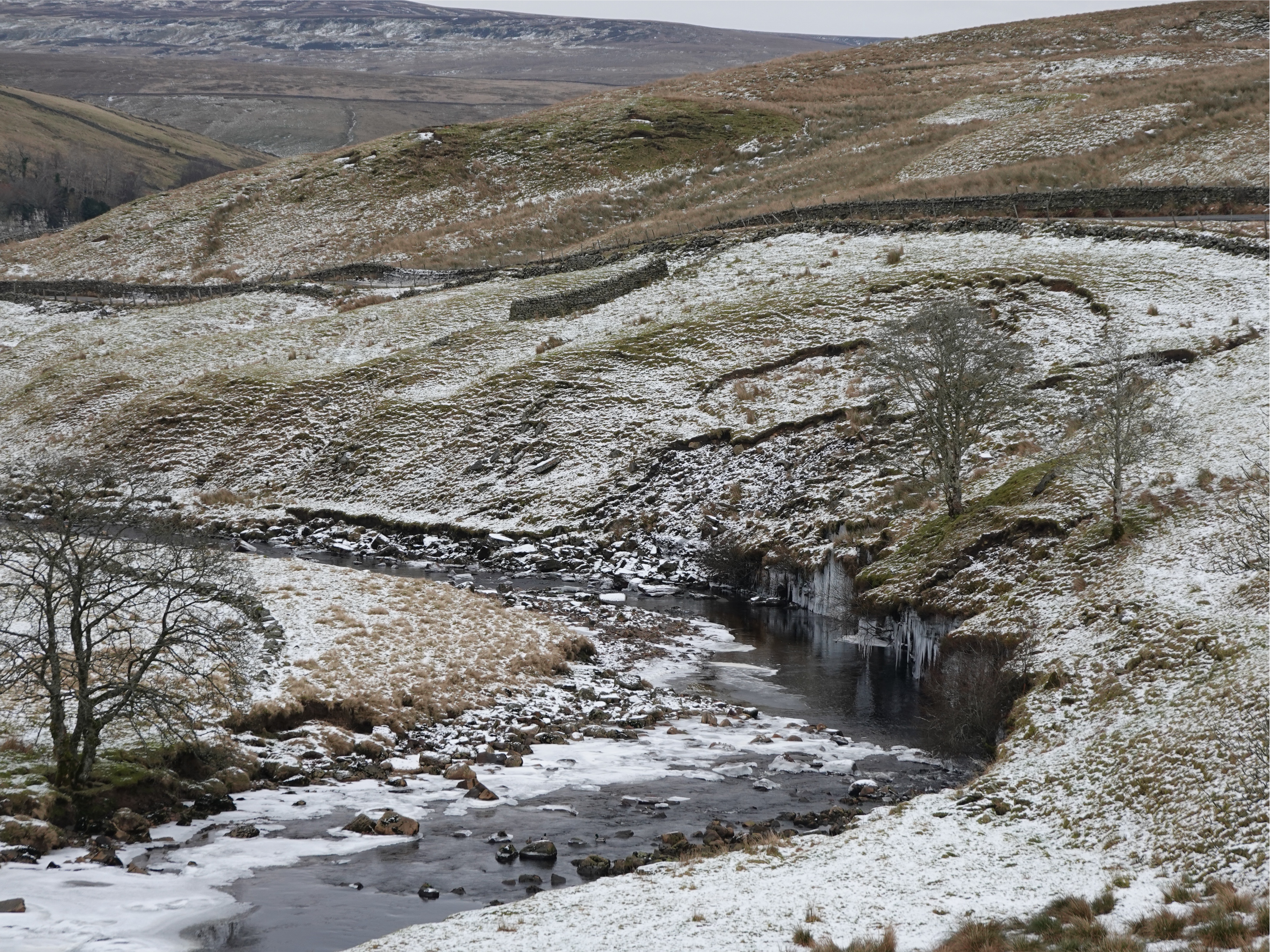
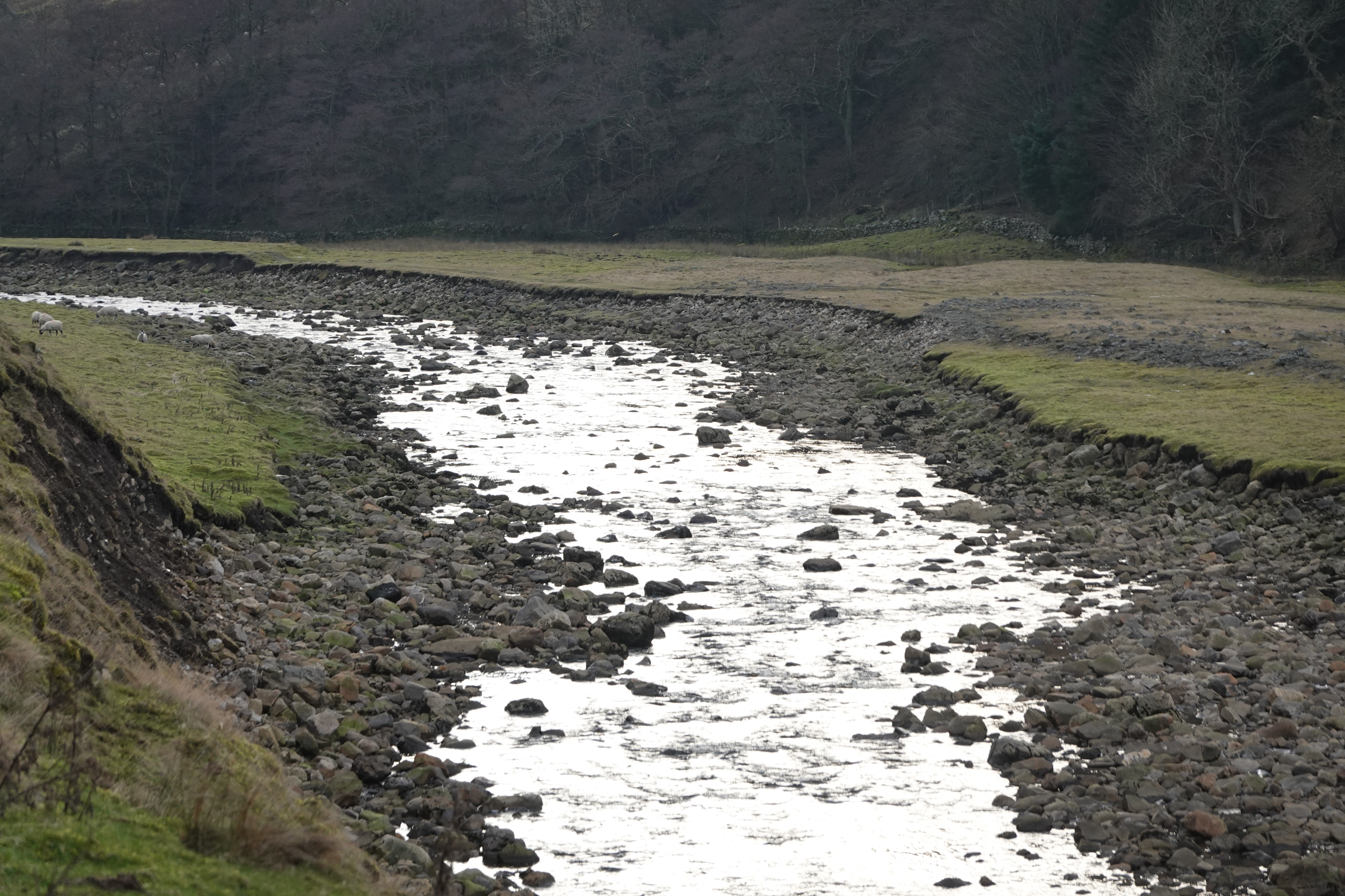
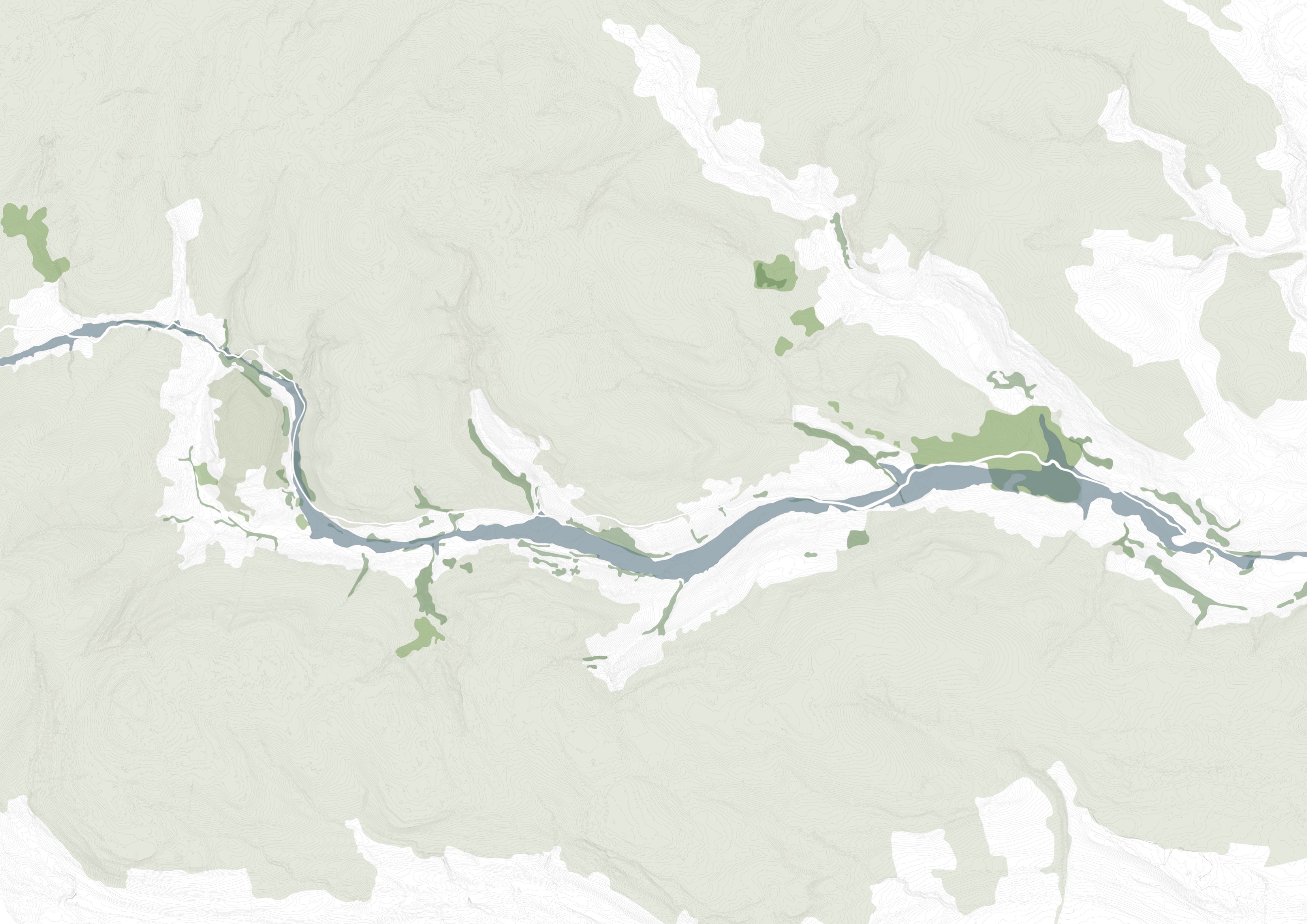
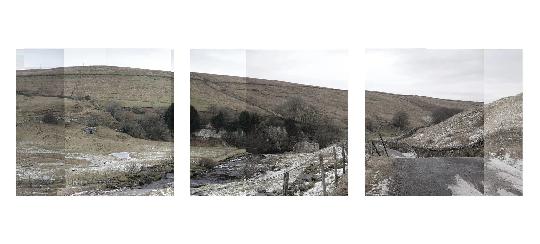
River Swale, located in a valley of Yorkshire Dales National Park, is one of the fastest rivers in England, running along the middle part of the famous Coast to Coast hiking route.
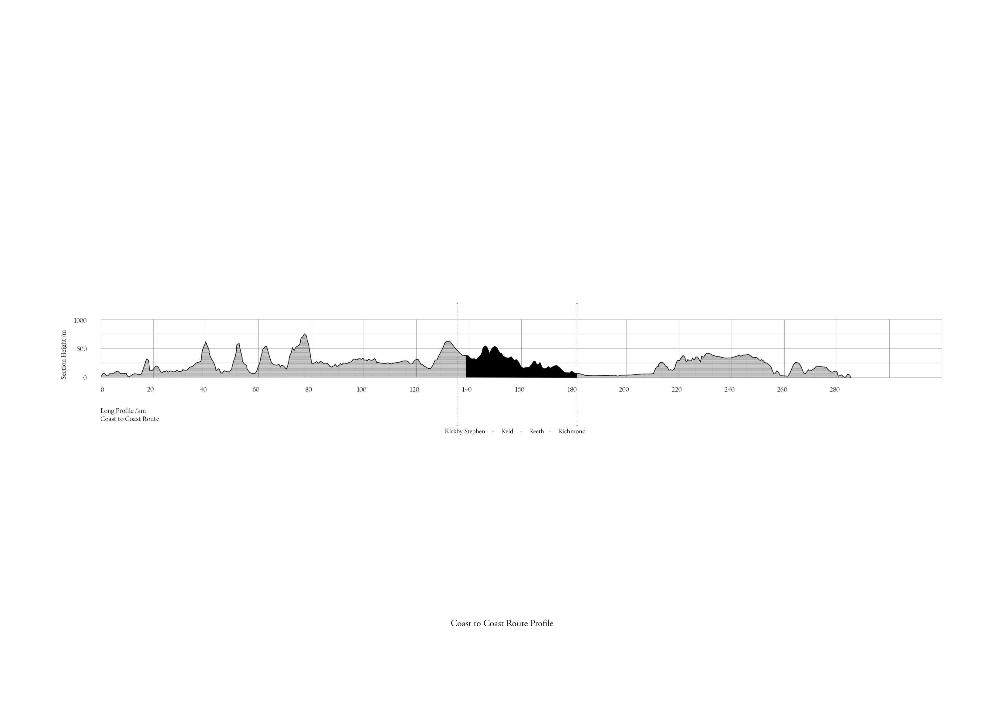
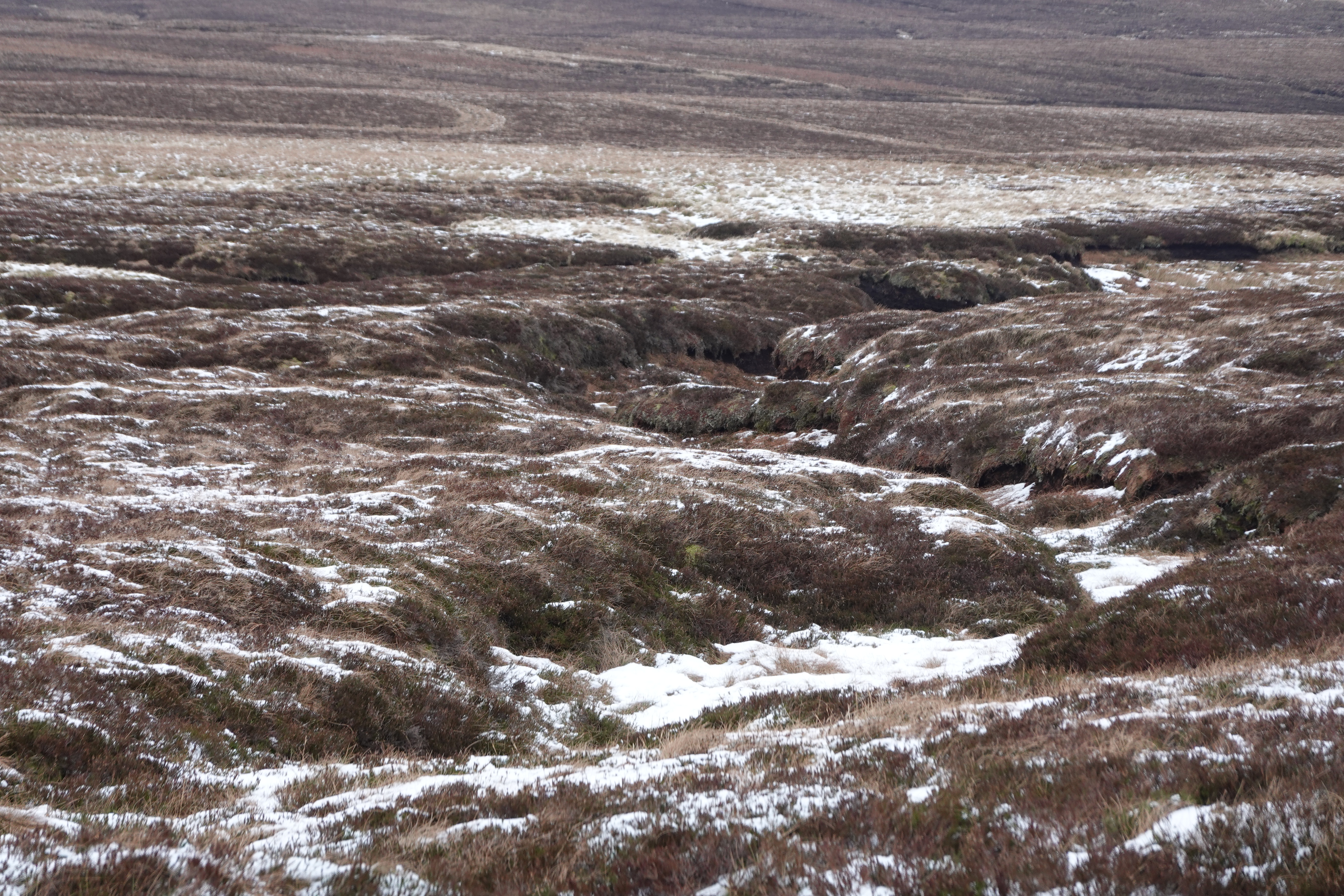
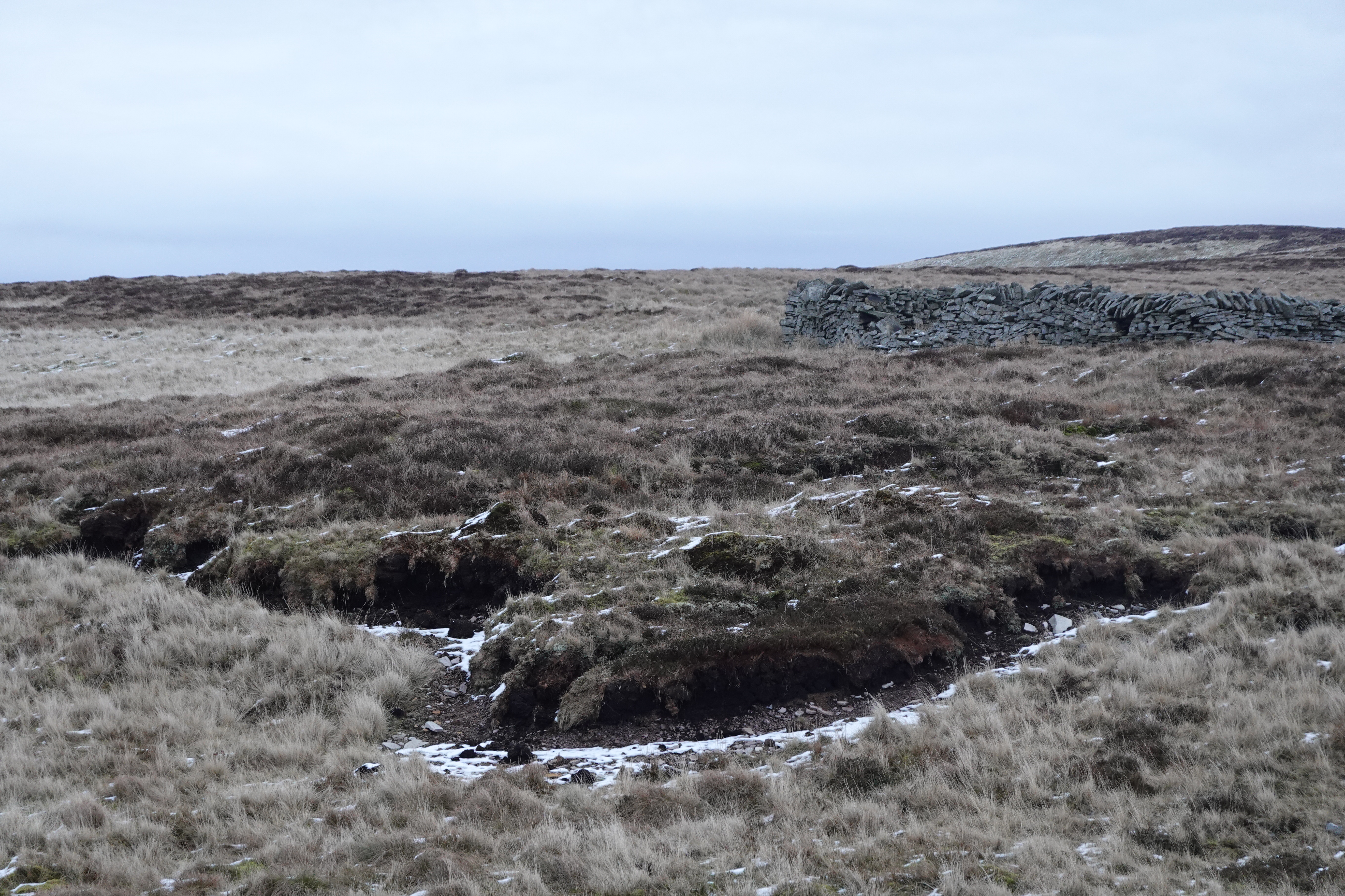
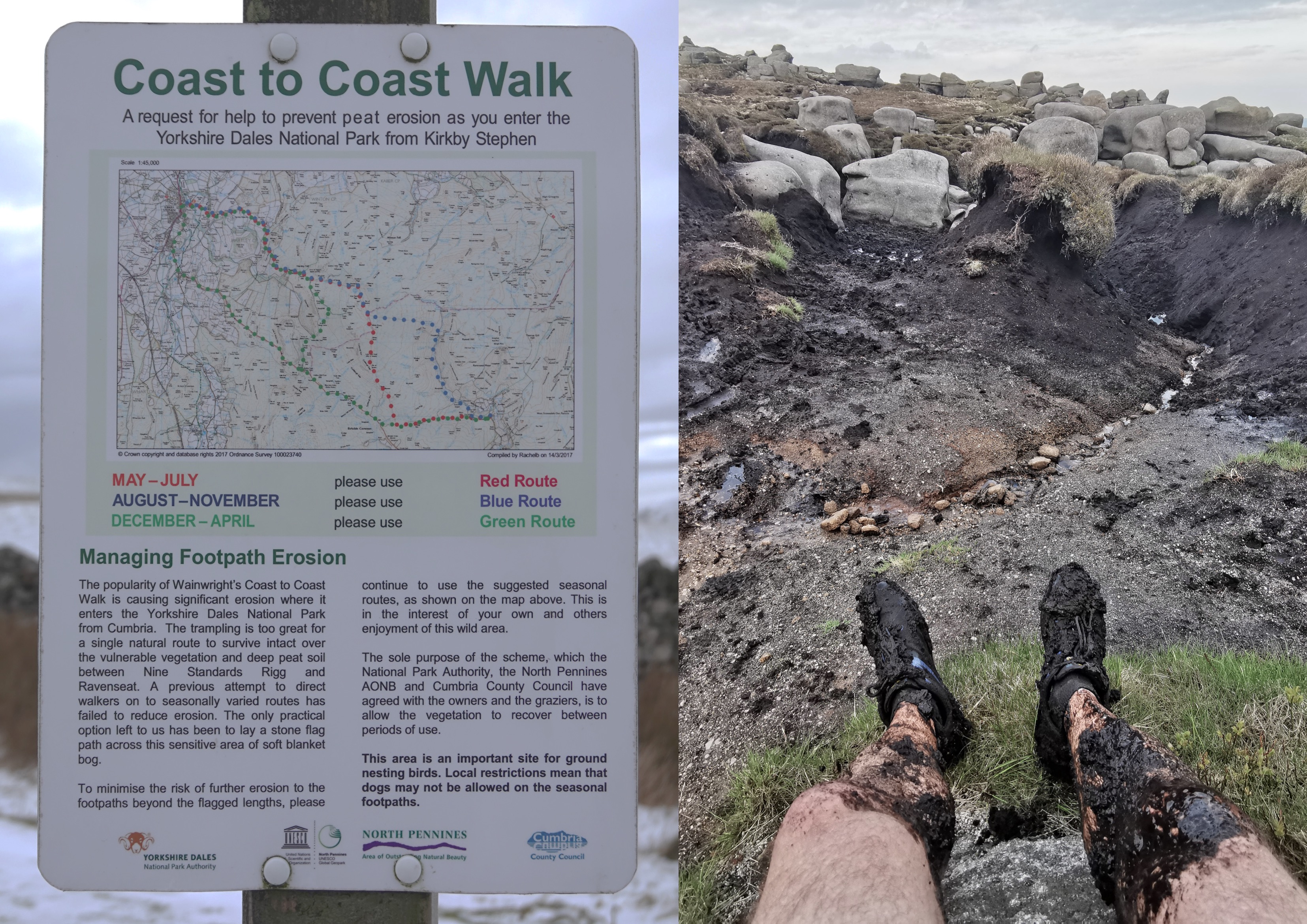
The route is a national trail, over 300km long, and typically takes 14 days to complete. I hiked along the river swale for 40km in one day, from Kirkby Stephen to Reeth, and found its rich and various landscapes.

Hiking documentary
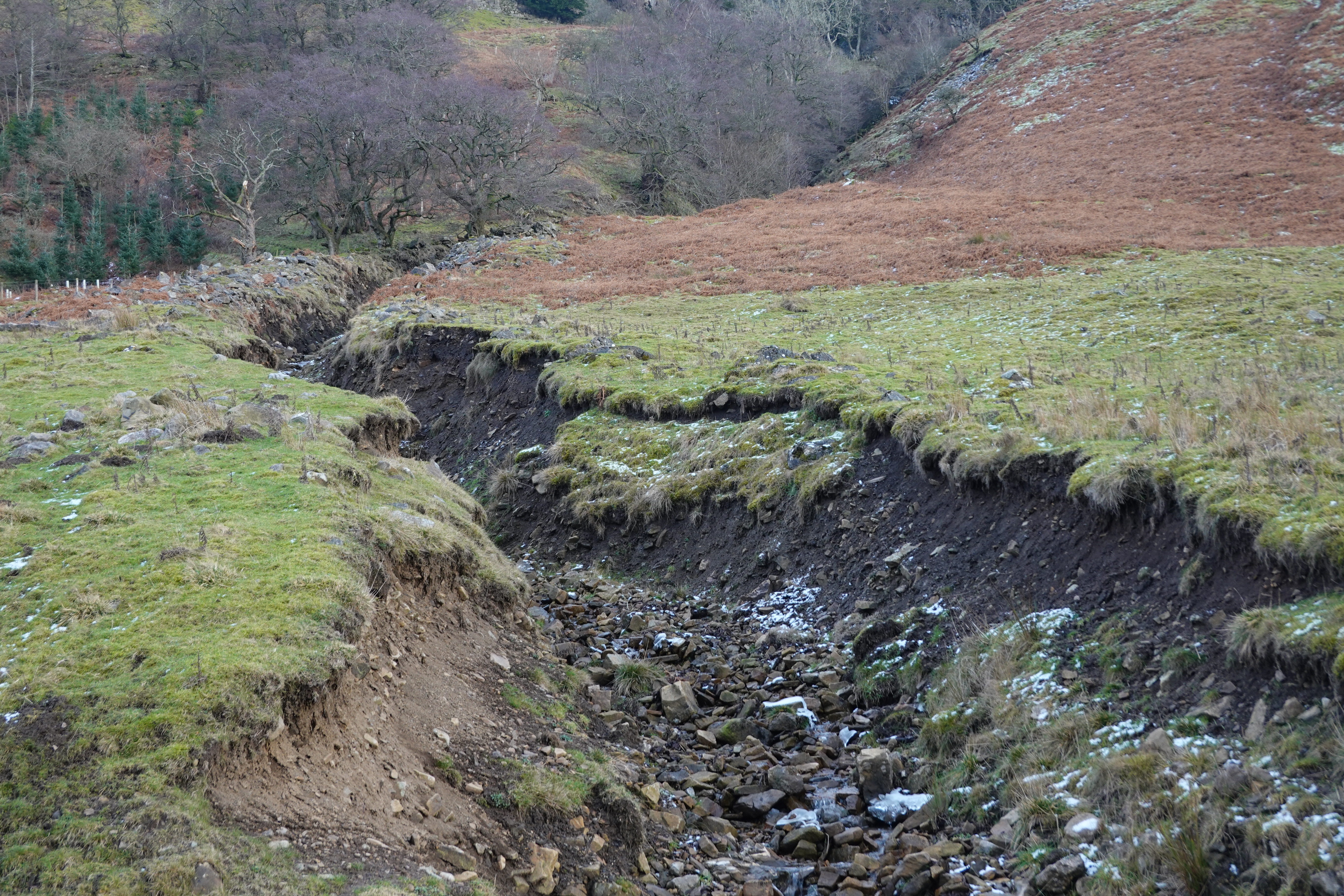
The photographs depict the merging of the river, bank erosions with disused mining heritages, and flooding at different points along the river from upstream to downstream. During the hike, I discovered that the trail was seasonal and lacked proper markings, posing risks such as getting lost and struggling in wetlands. The project also aims to provide resting spots for hikers.
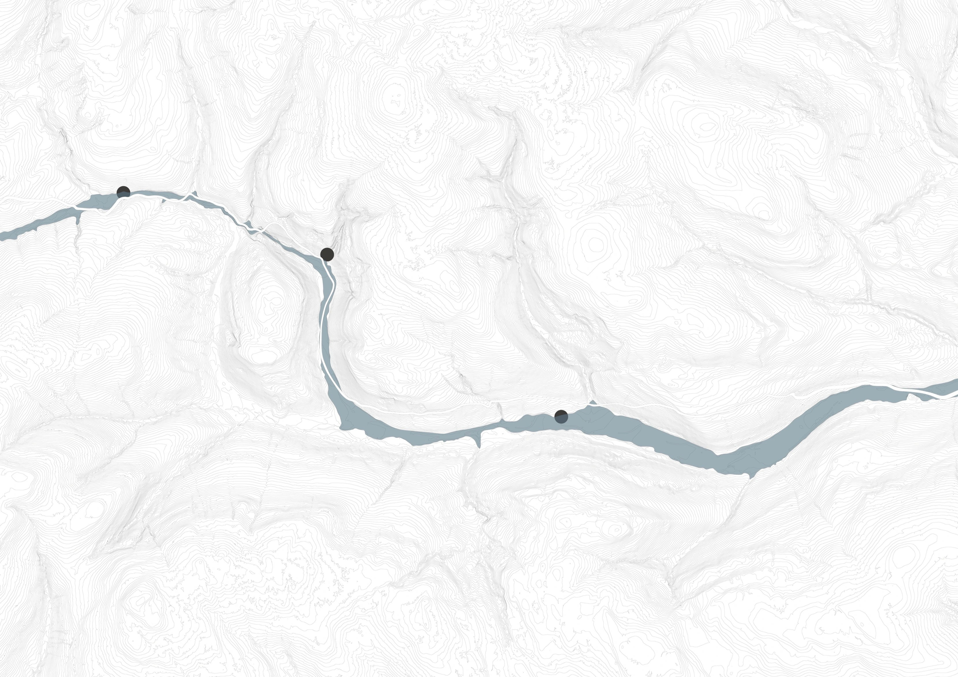
Three sites are picked as a test trial along the river, spreading from upstream to the middle stream. The running water strings them. The route invites hikers.
#2 Geography _ Research / Documentation


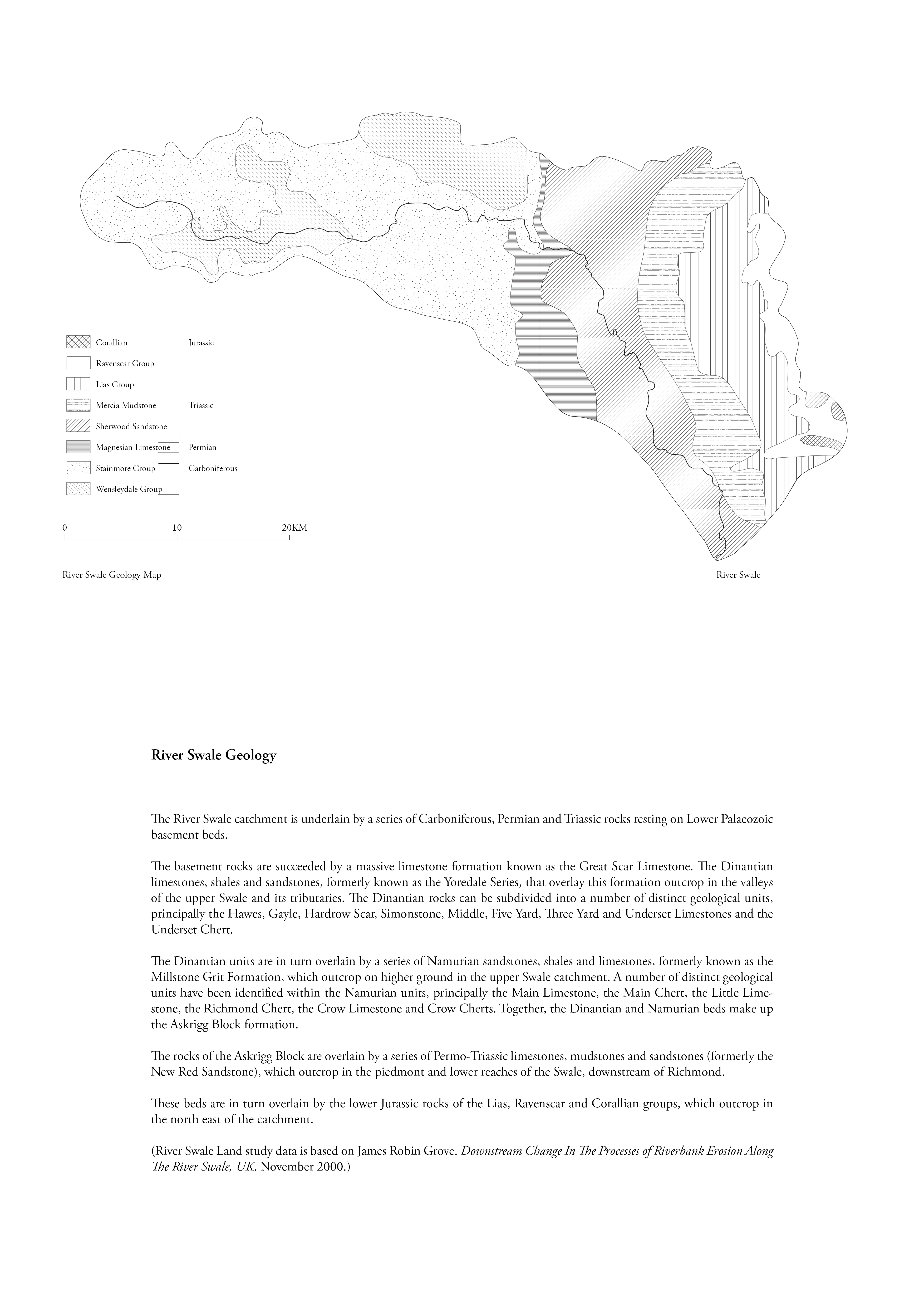
_ River Swale Geography


_ Landscape backlash
#3 Building as Landscape _ Thinking through making


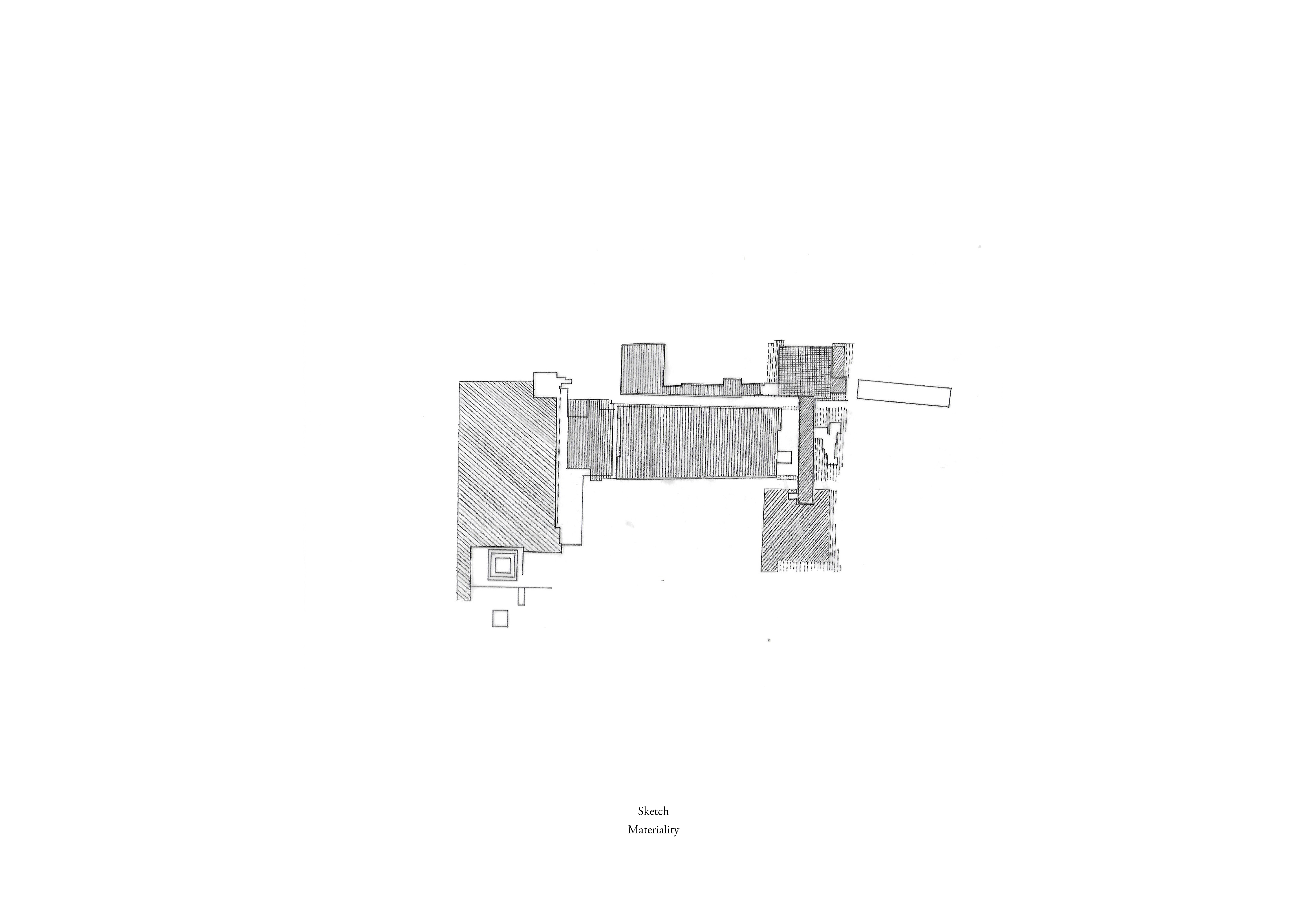

Case study
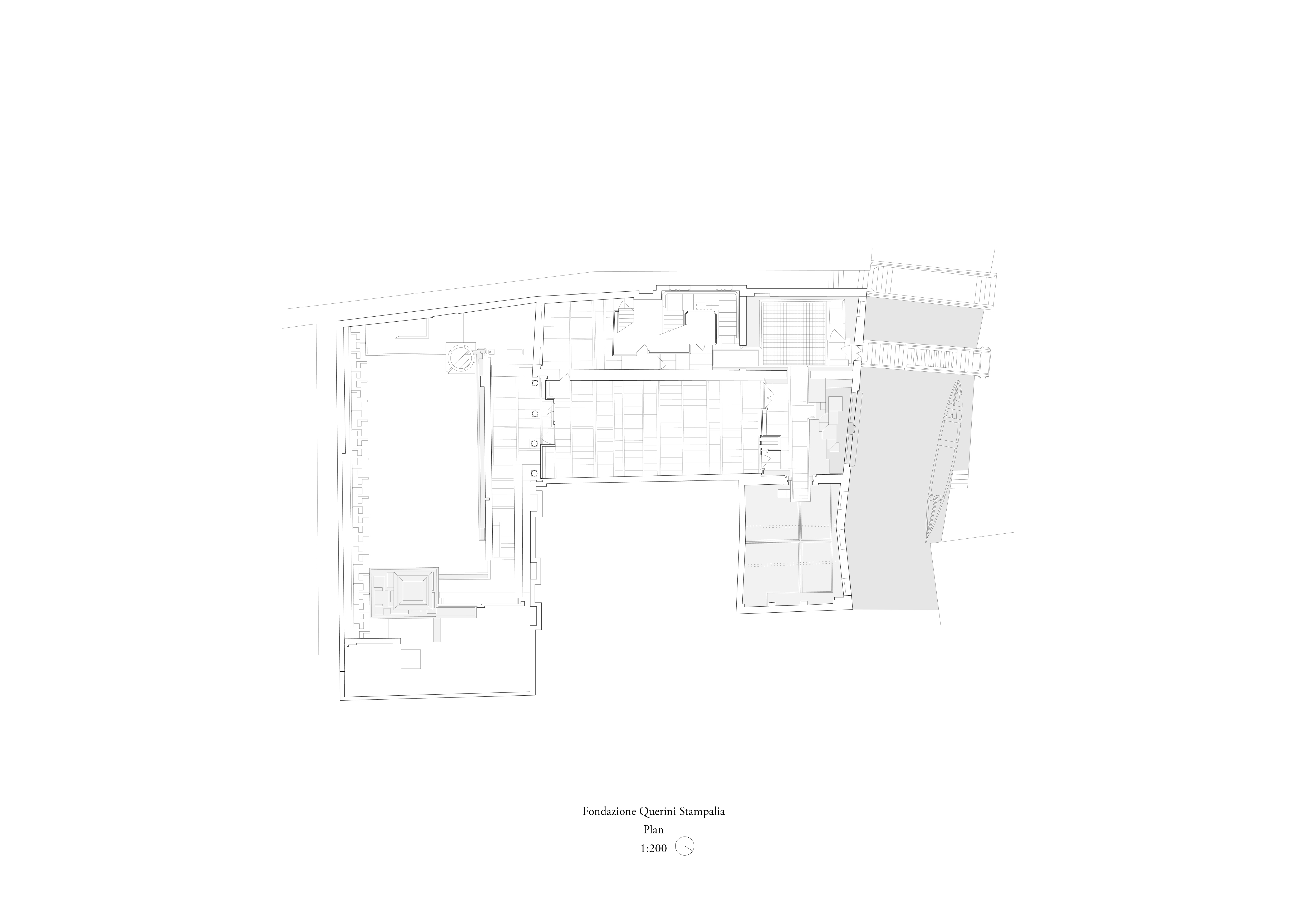
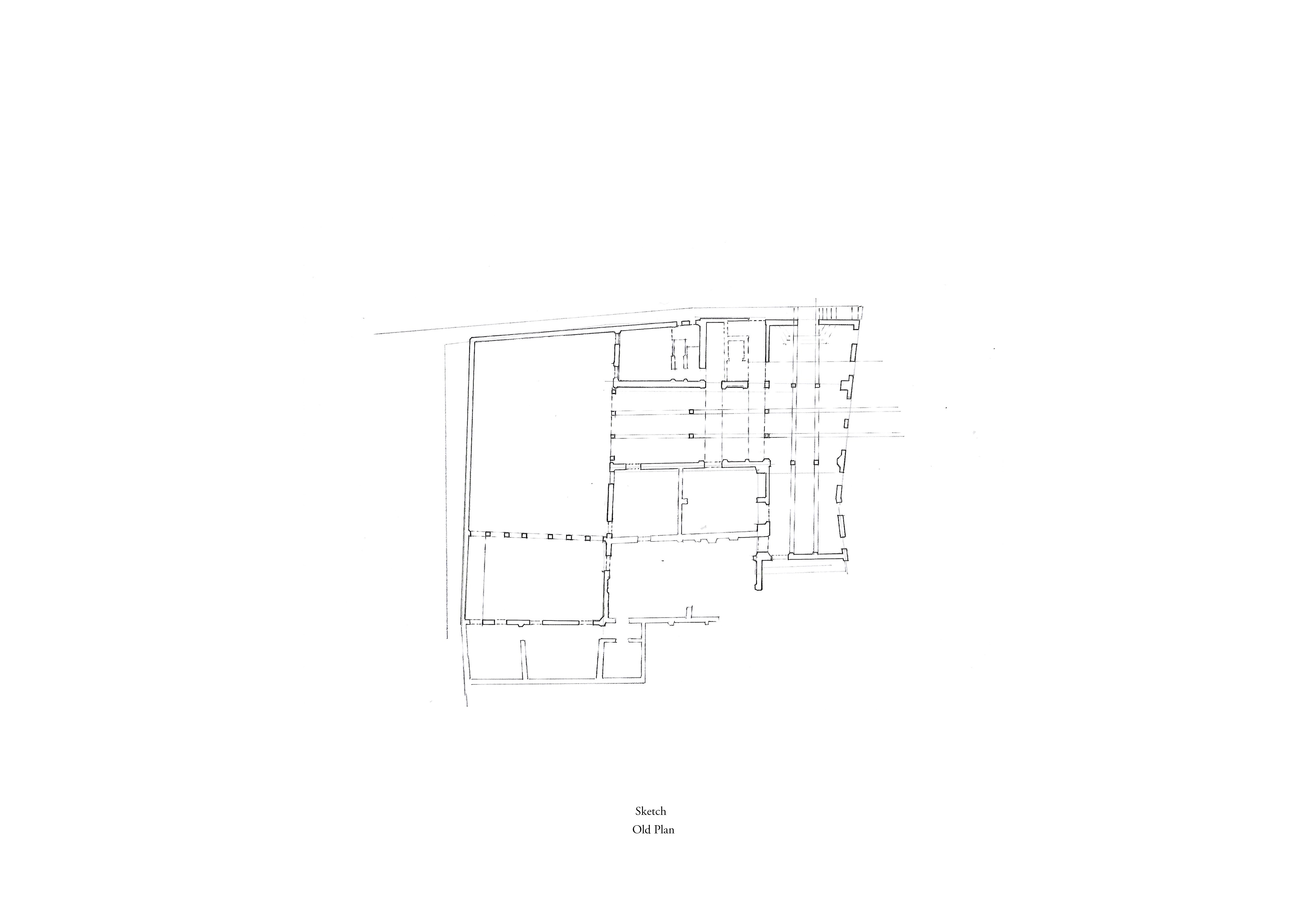
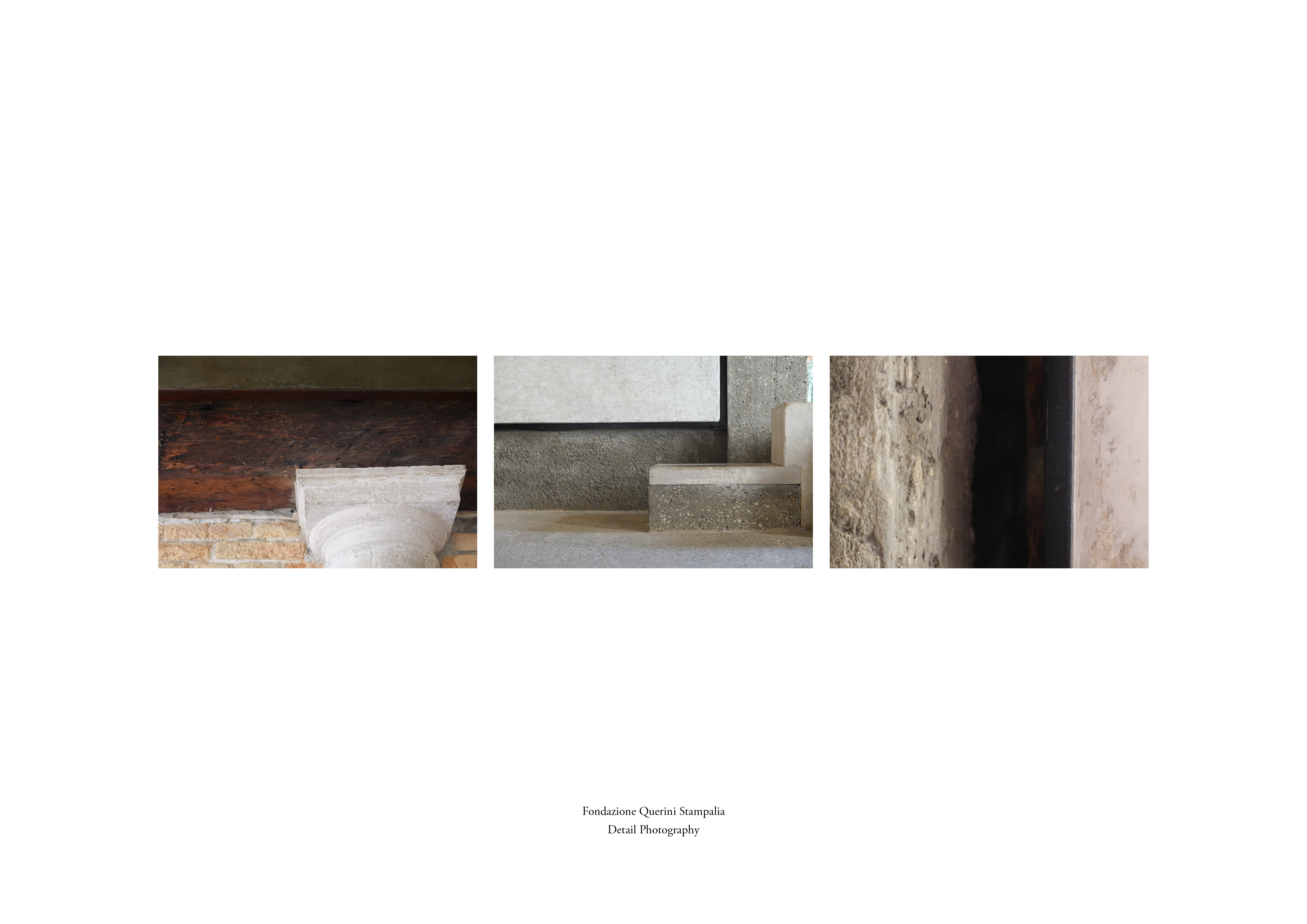
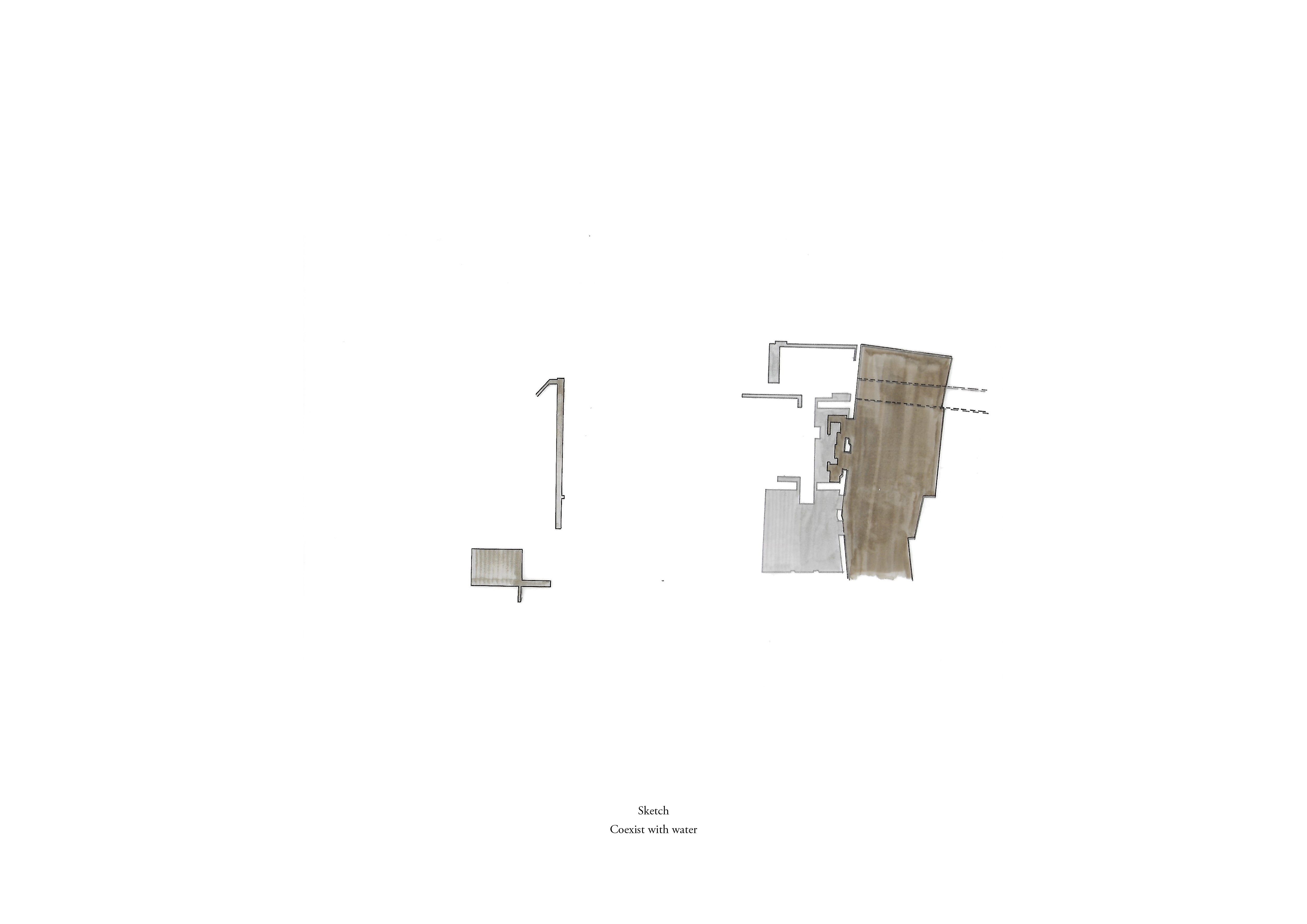
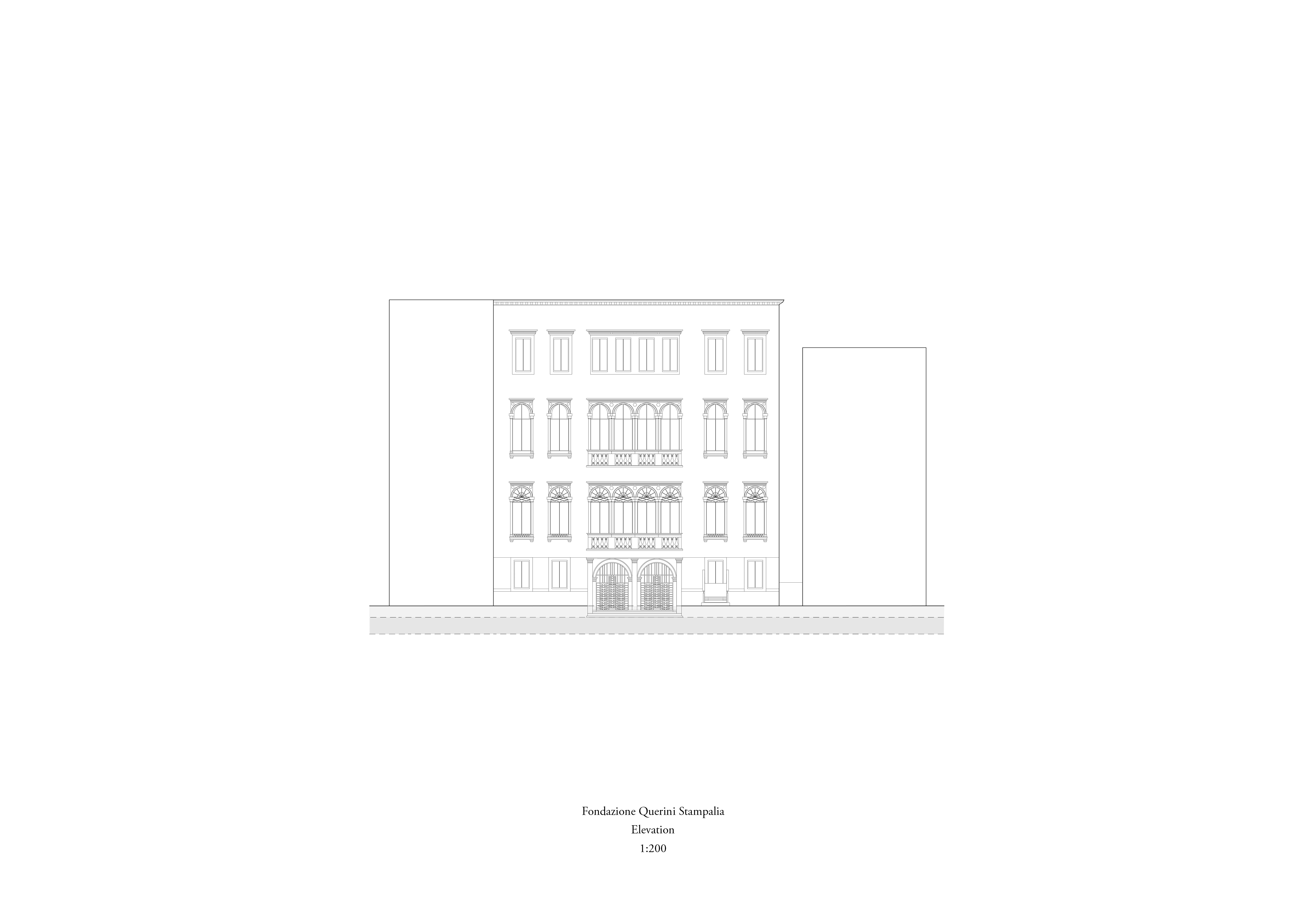
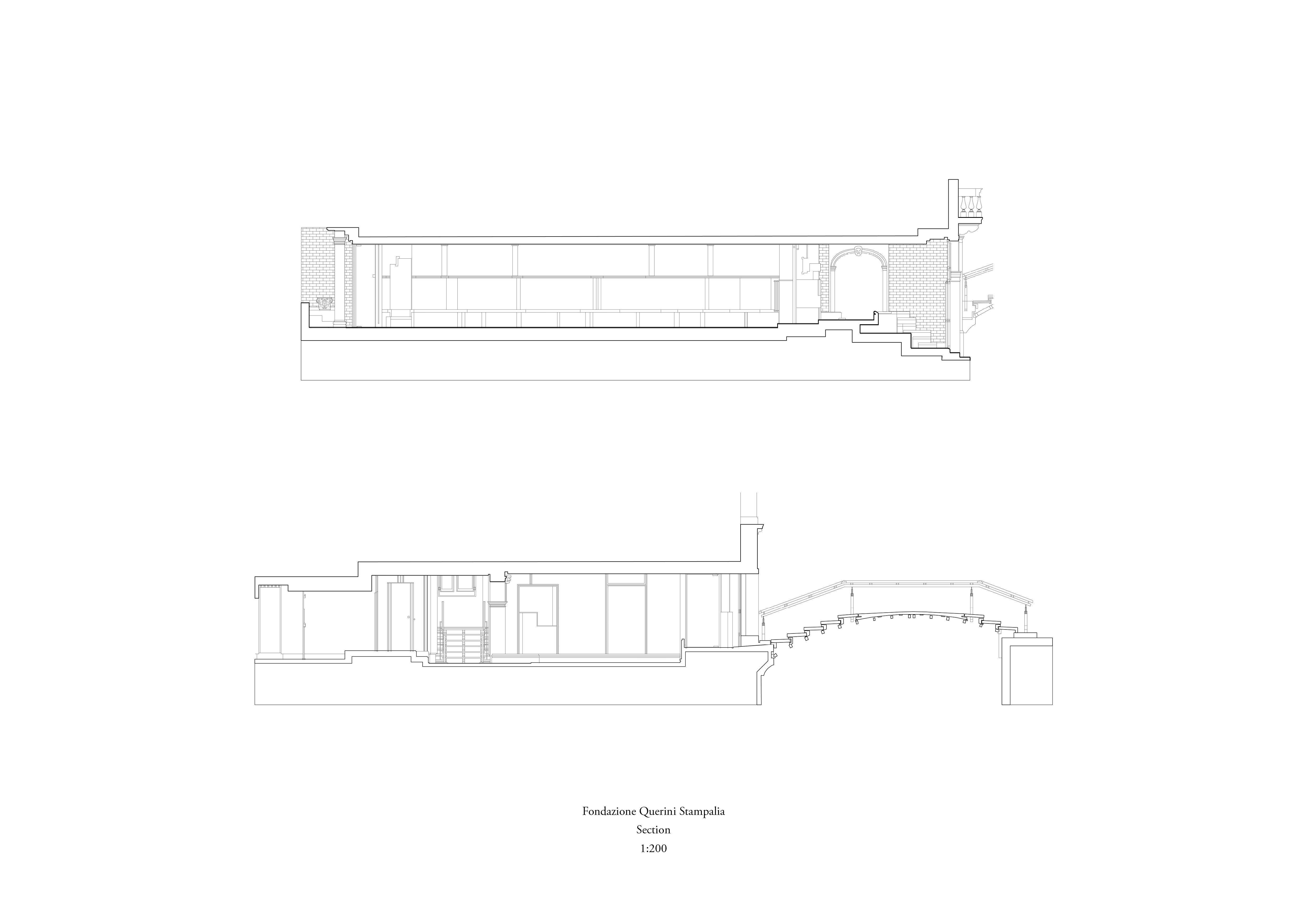
Inspired by the prevention solutions from Carlo Scarpa’s Foundation Querini Stampalia in Venice, the study extracted clever touch designs that increase people’s awareness of both old buildings and flooding in Venice through research, modelling and drawings.
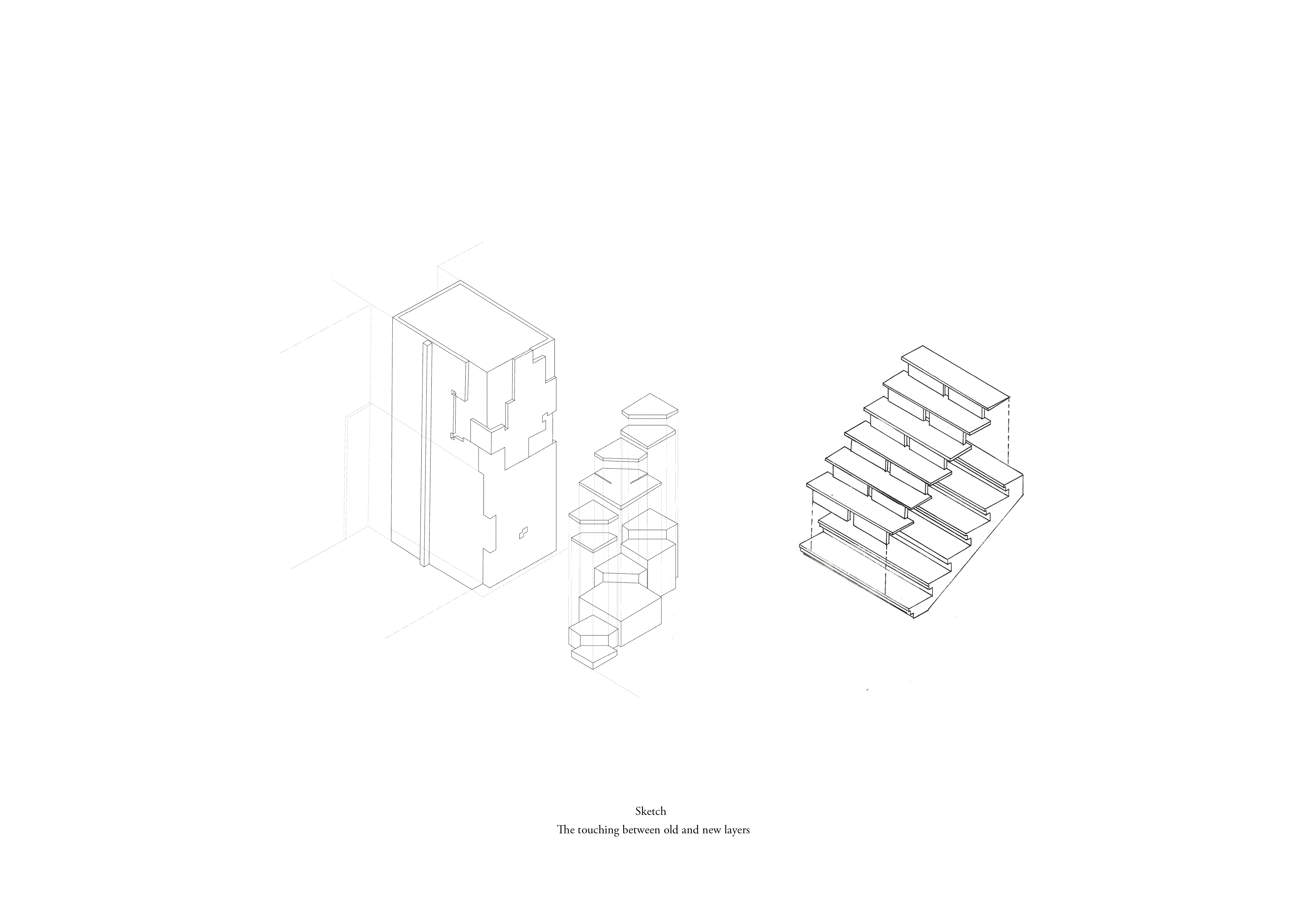
Firstly, the coexistence of water and people. Instead of blocking the flooding, Scarpa used the water as a material to surround and connect the whole building, making people walk on the newly built stage, creating a sense of weightlessness to feel the flooding. Secondly, he respected the historical layers, trying to leave gaps, creating a unique touch and tension between new and old materials.

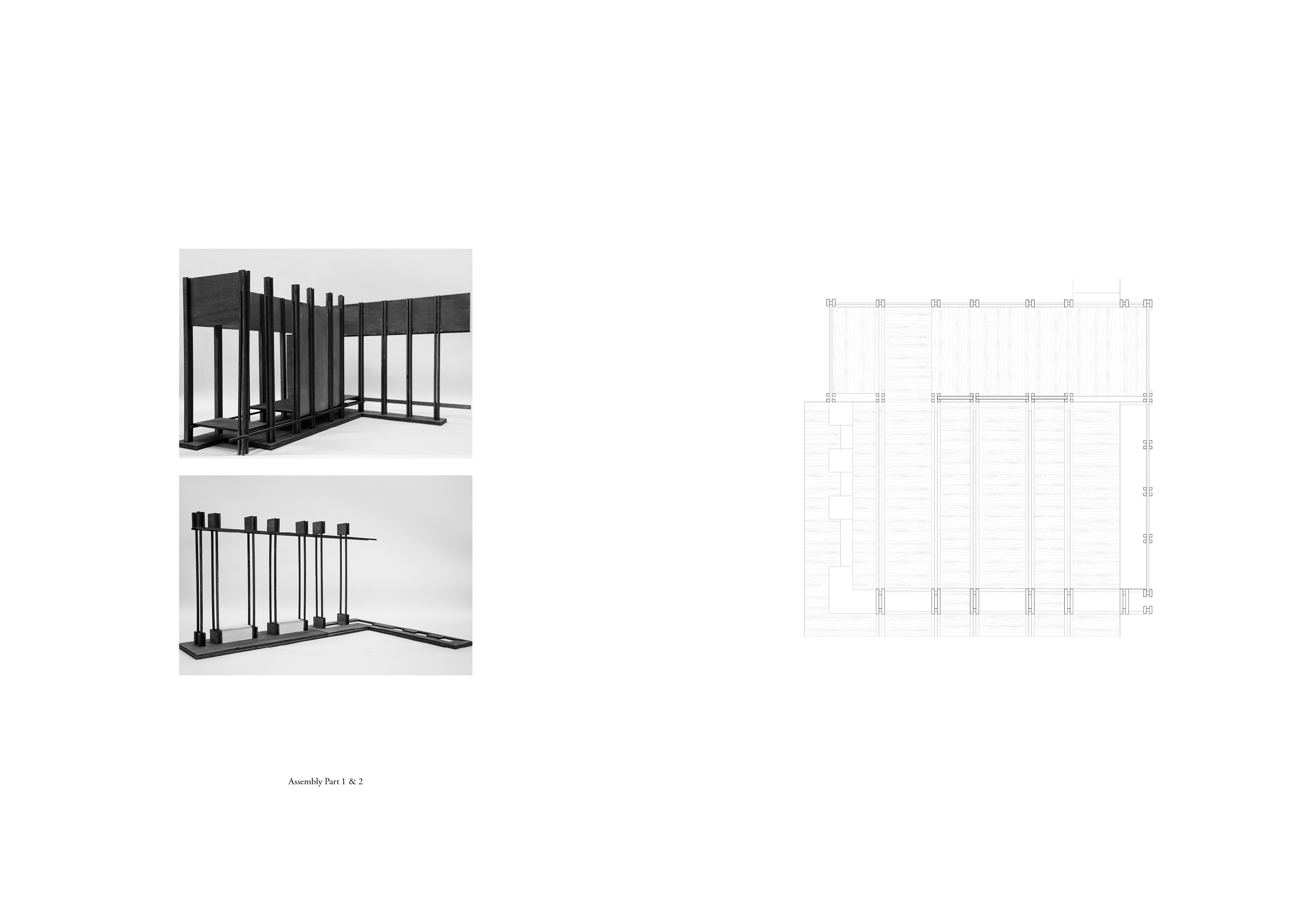
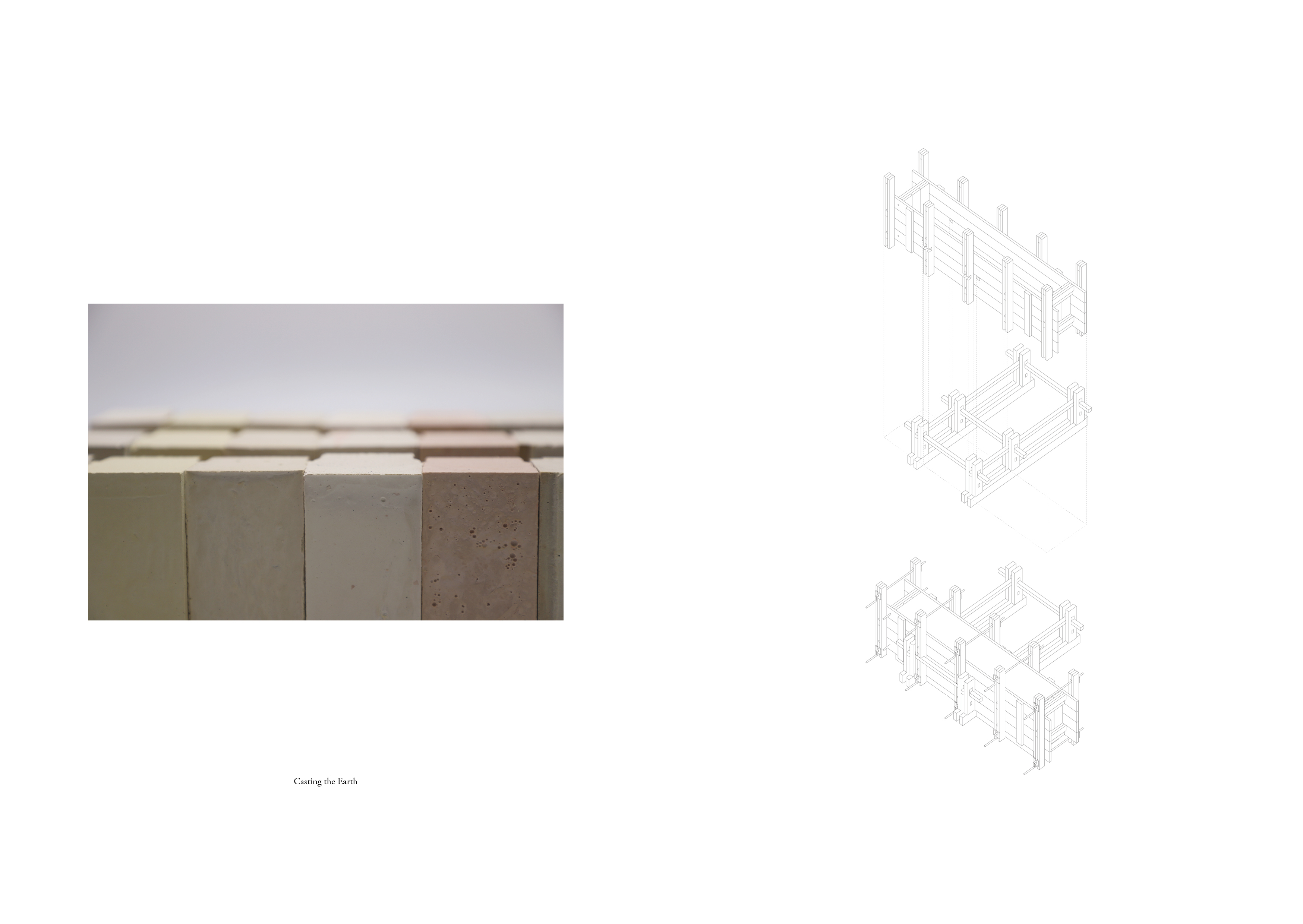
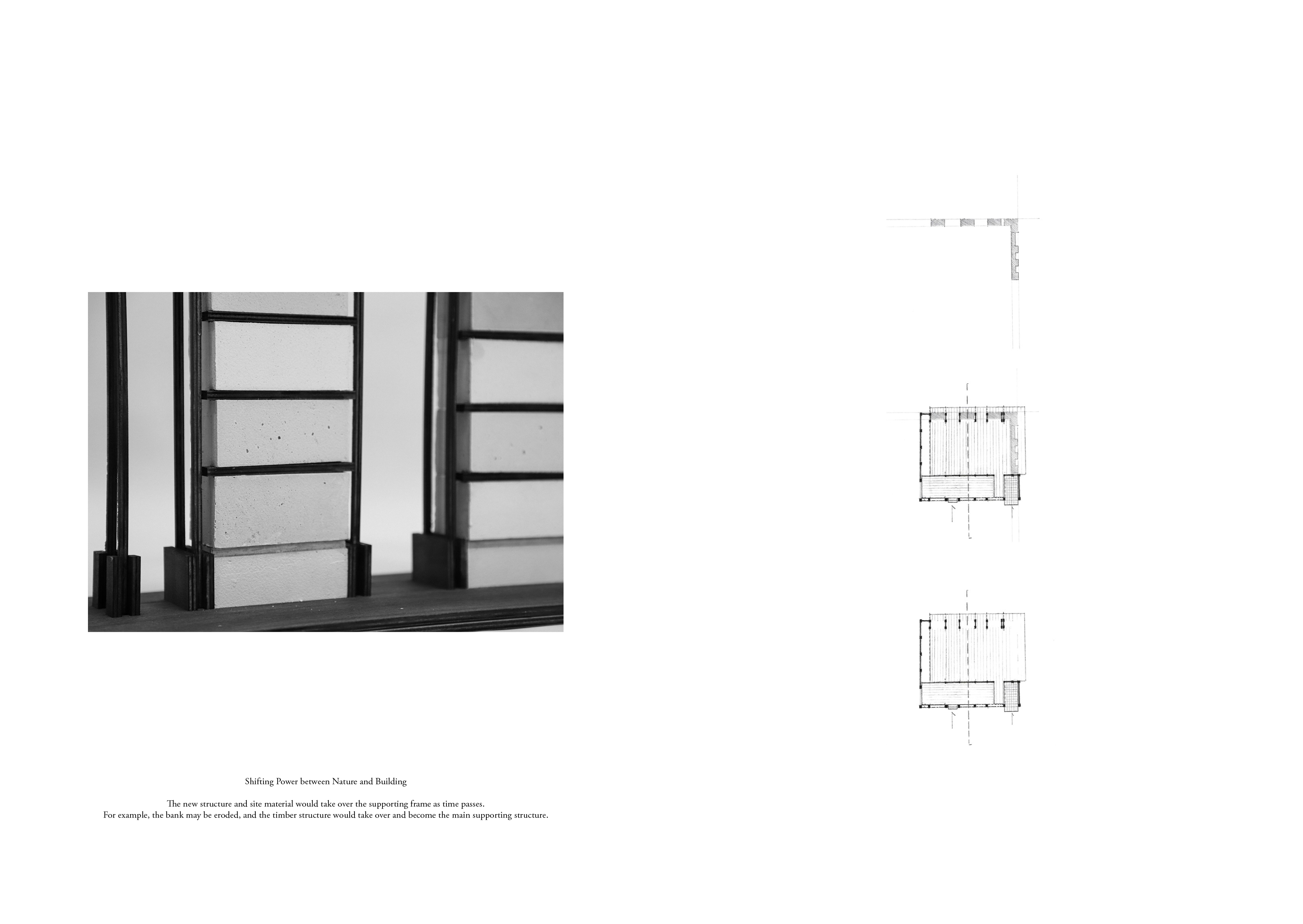
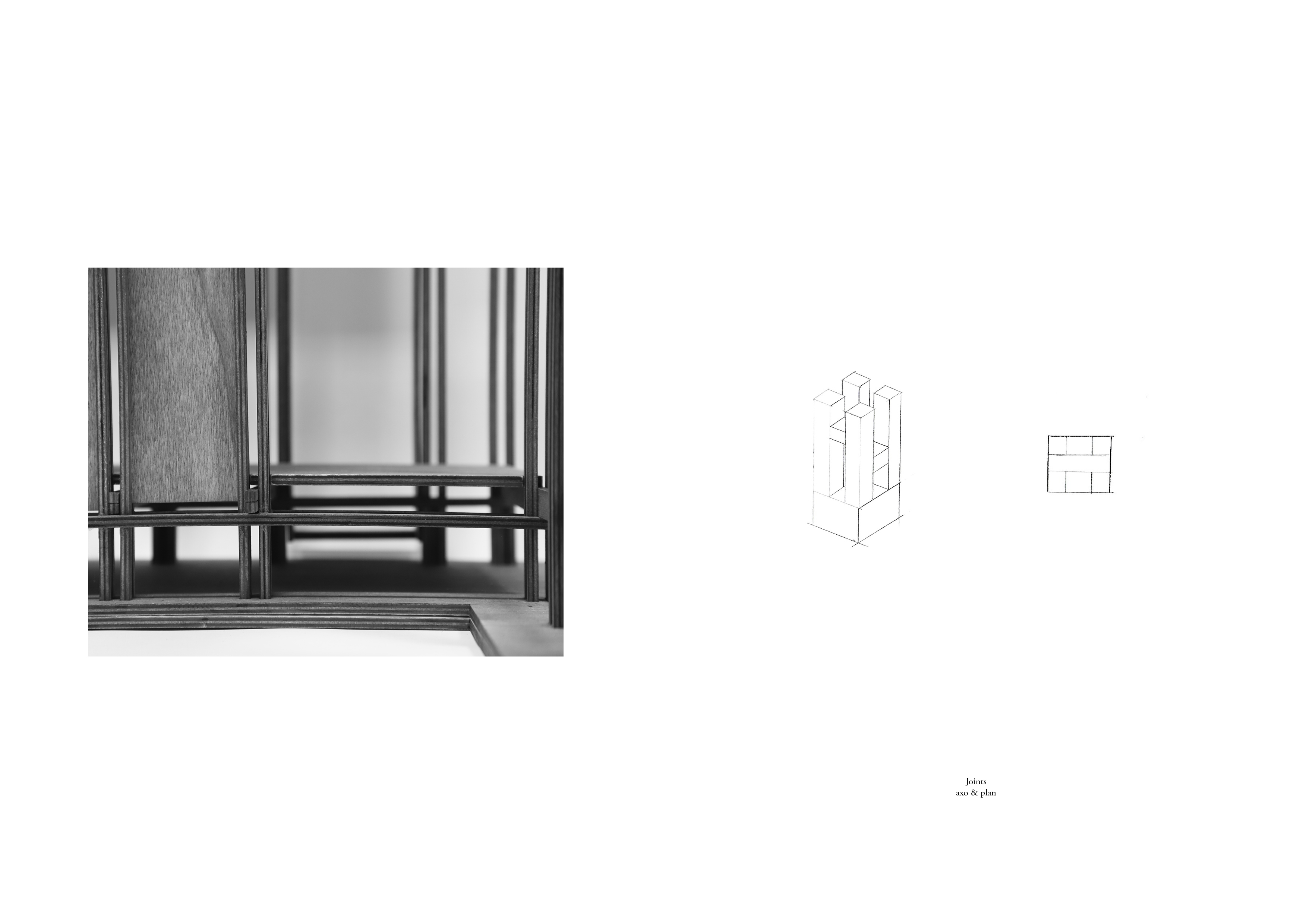
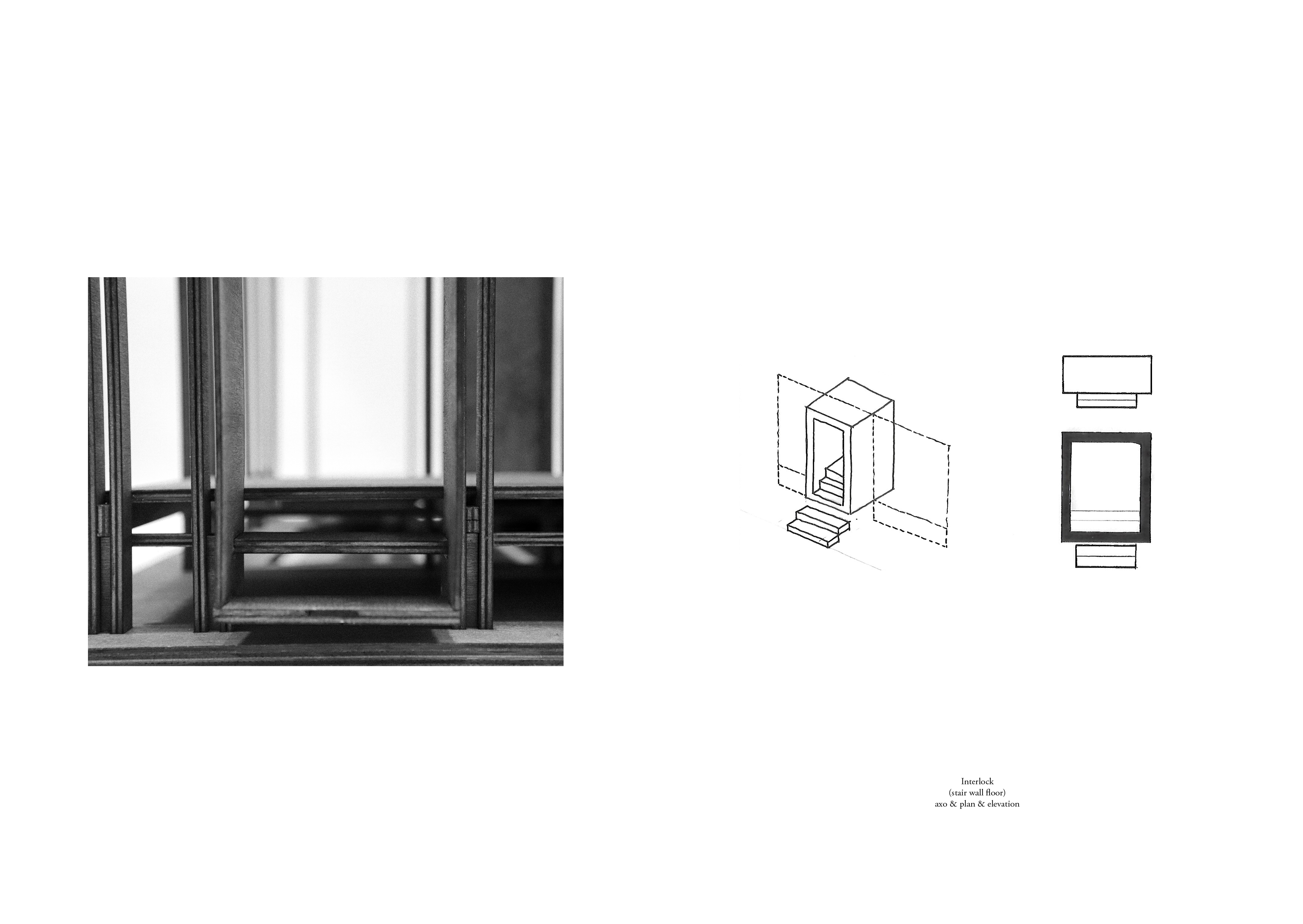

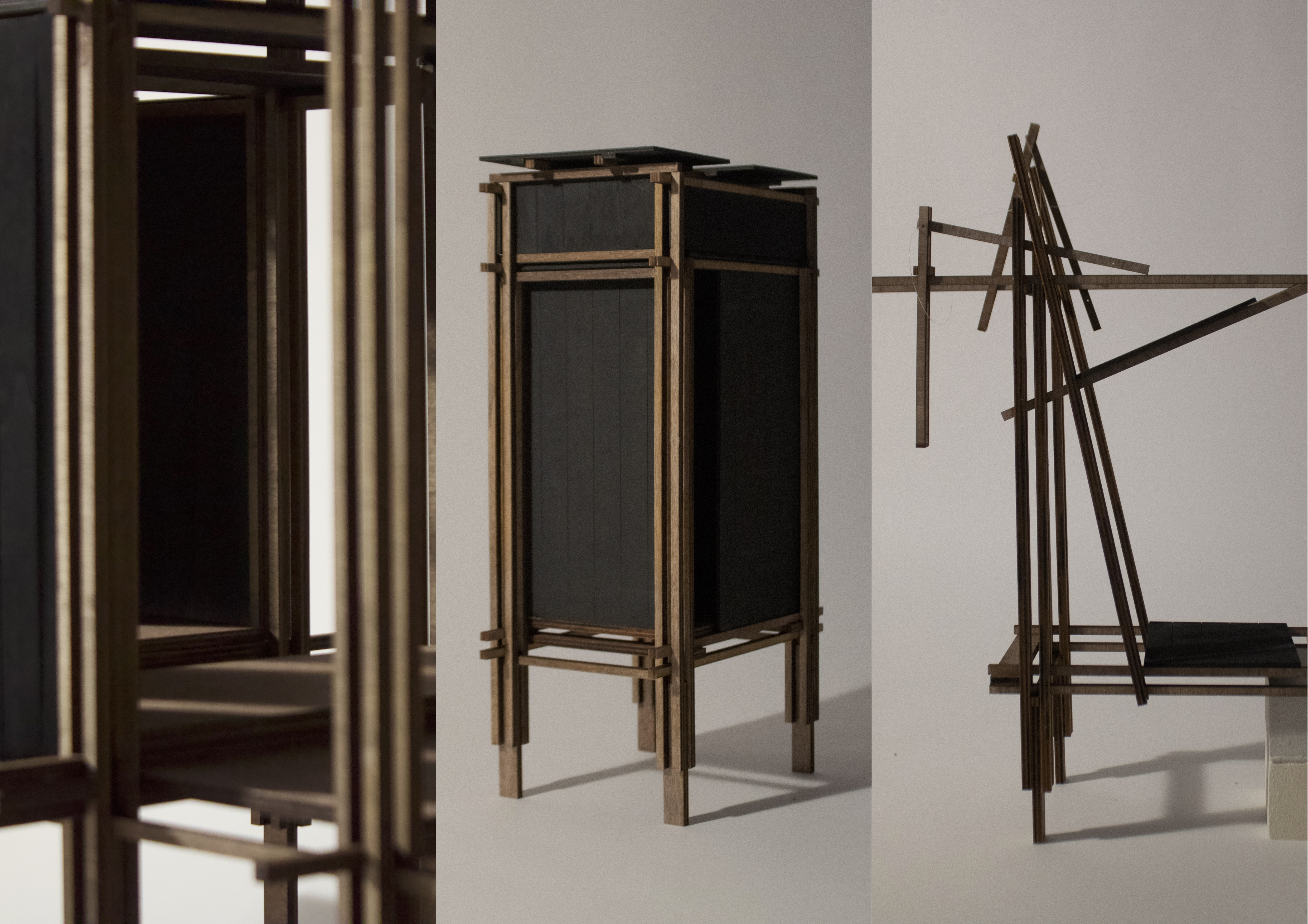
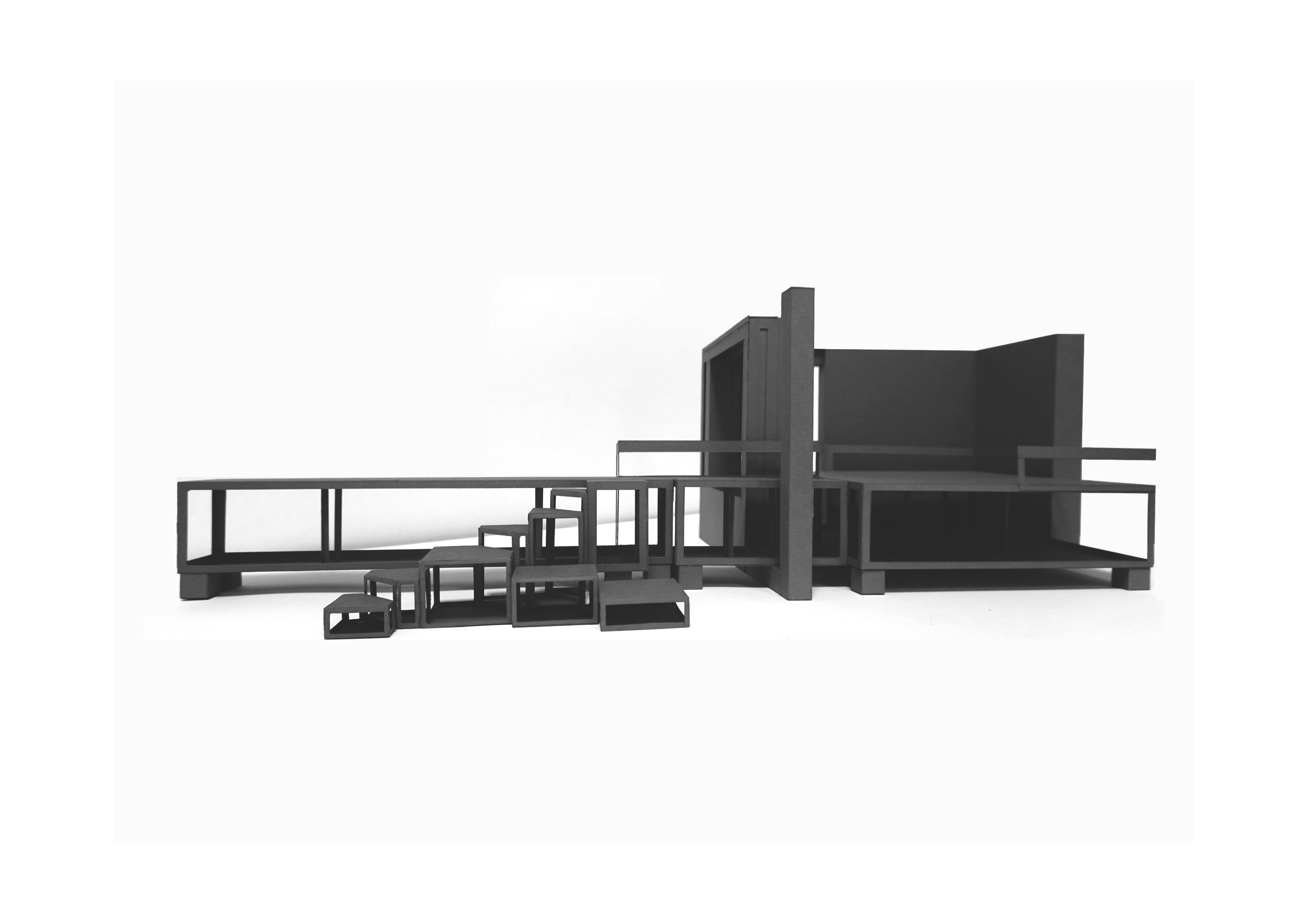
Assembly model
The model was made to apply to the river site and echo its historical mining equipment and memory. It is also a toolbox for exploring structural flexibility; for example, by using the casting as the earth, the new structure and site material would take over the supporting frame as time passes. It provides a series of solutions to adapt to the shifting landscape on sites.
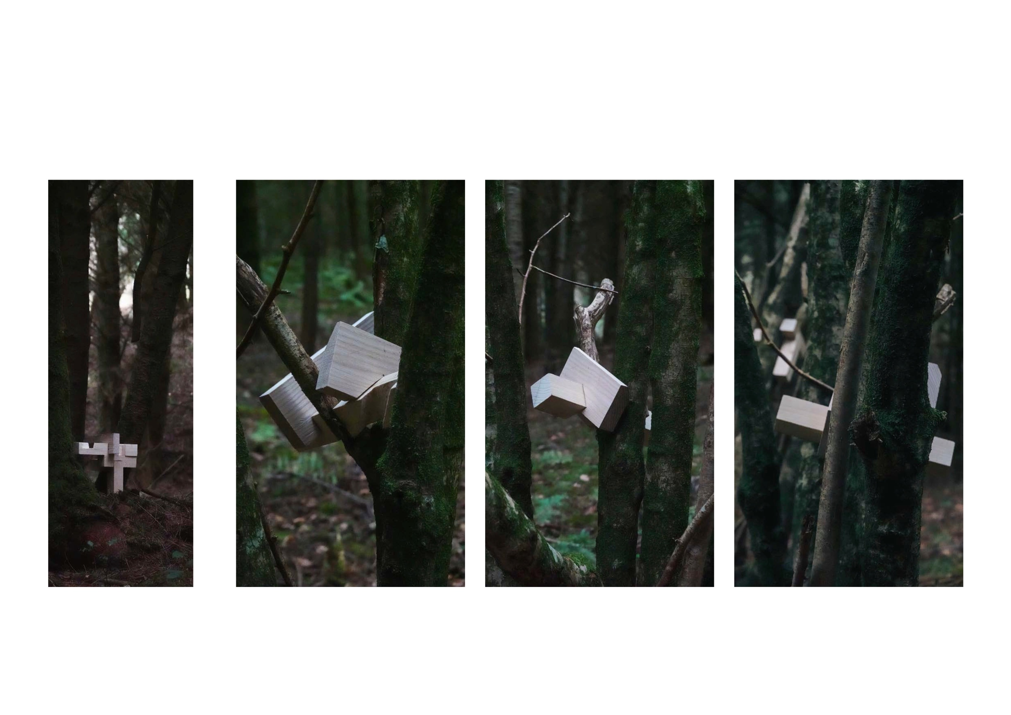
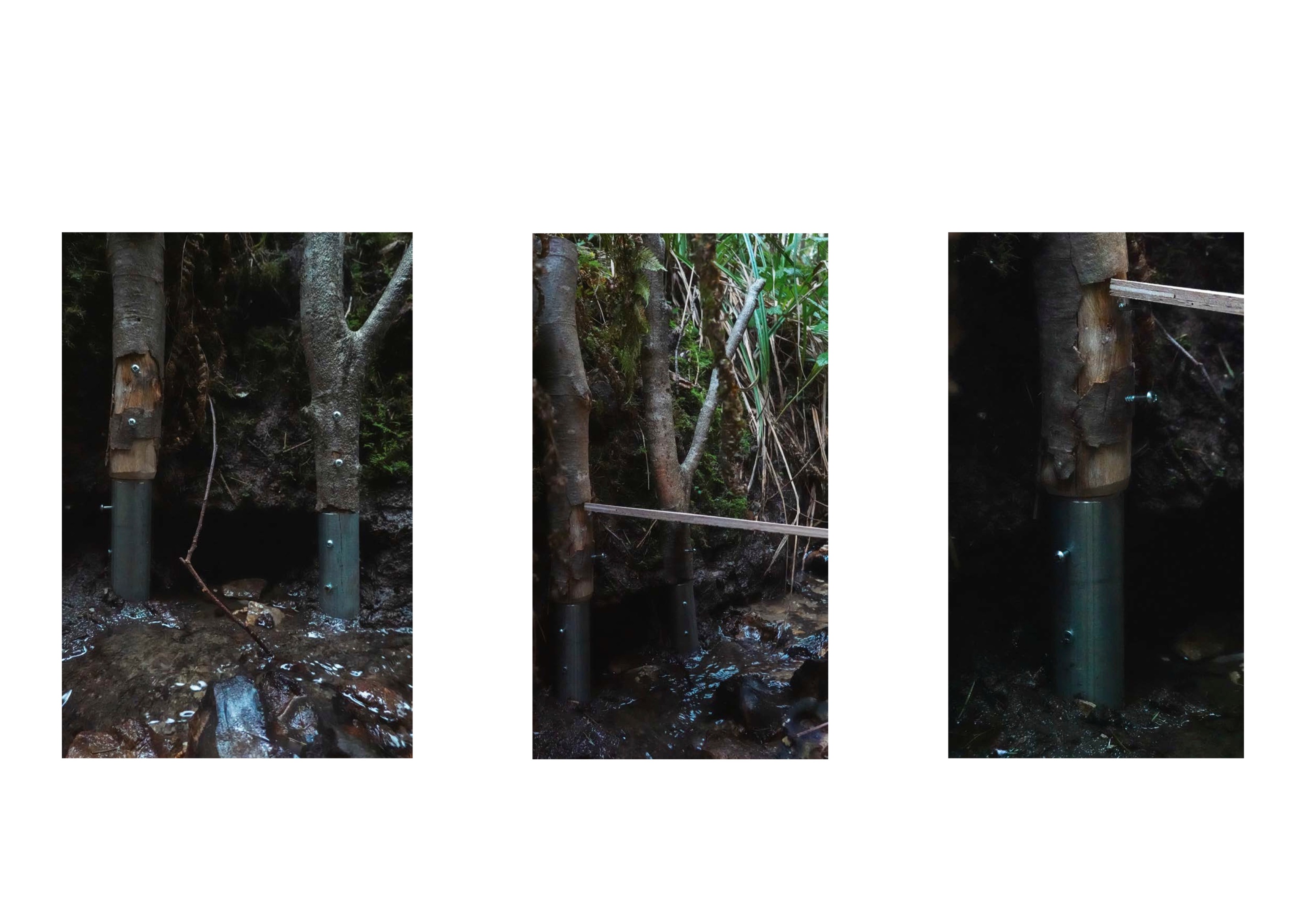
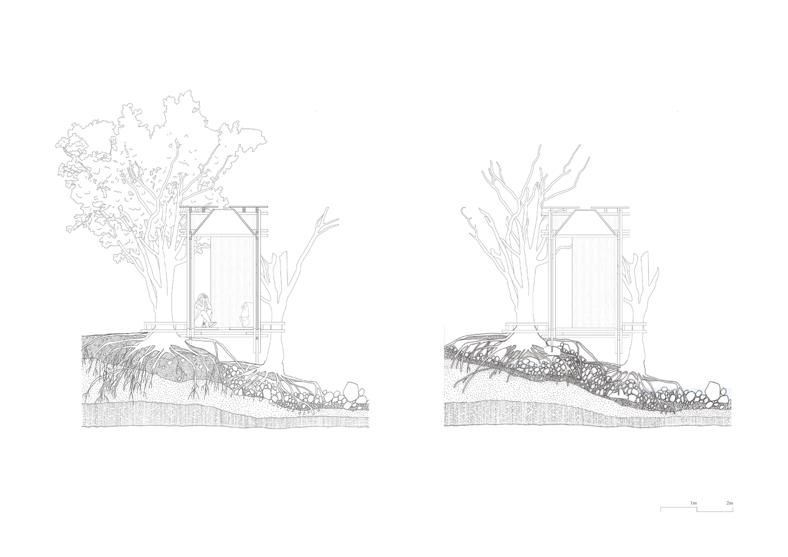
Testing model
Thinking of assembling the natural elements on sites, I did some tests to make new builds to interlock with trees, create a new foundation, or, with branches, create a new joint. The test also attempted to incorporate natural materials in the construction process while exploring ways to redesign them for optimal structural integrity.
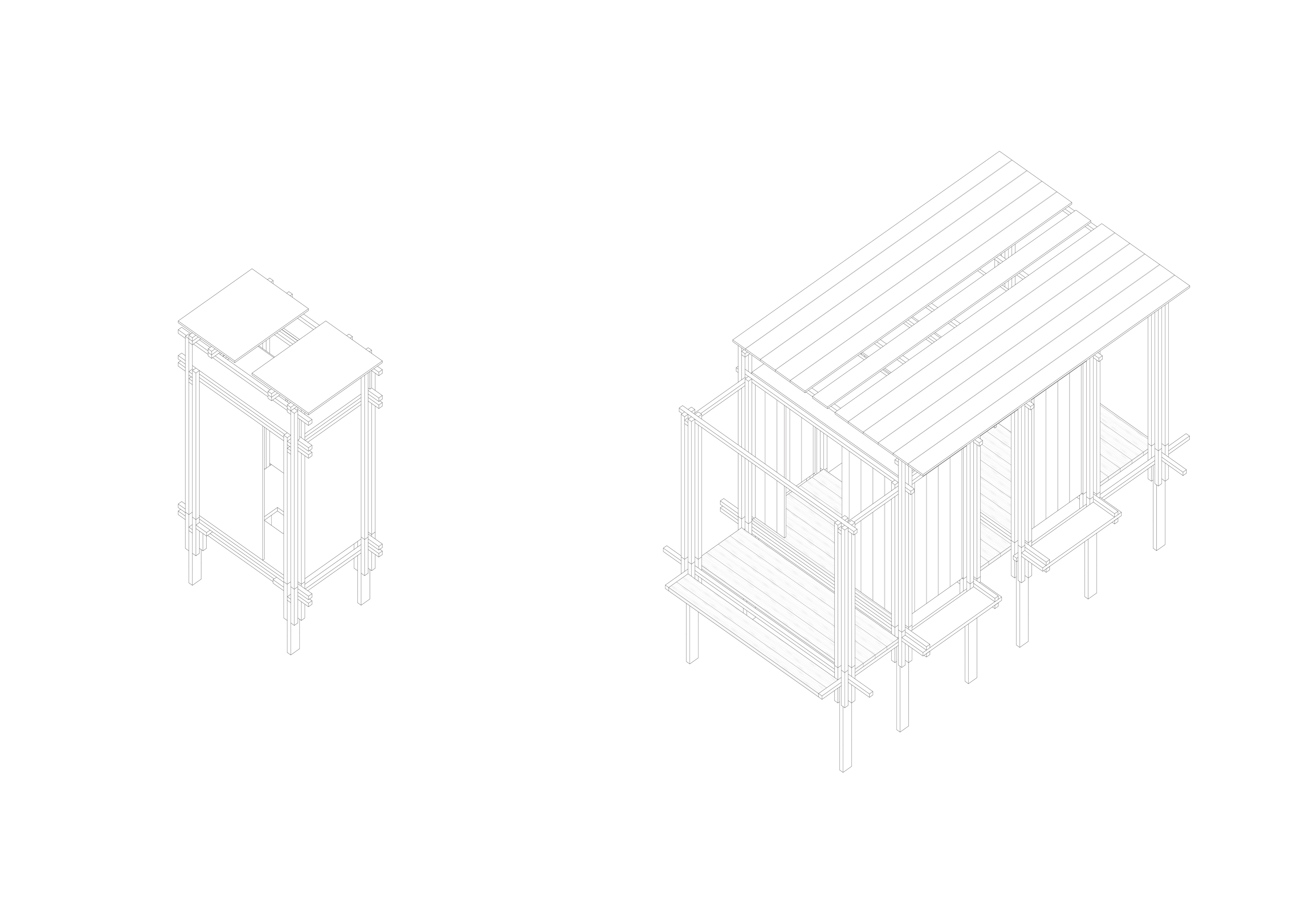
#4 Intervention
_ Site 1 Cotterby Scar Complex
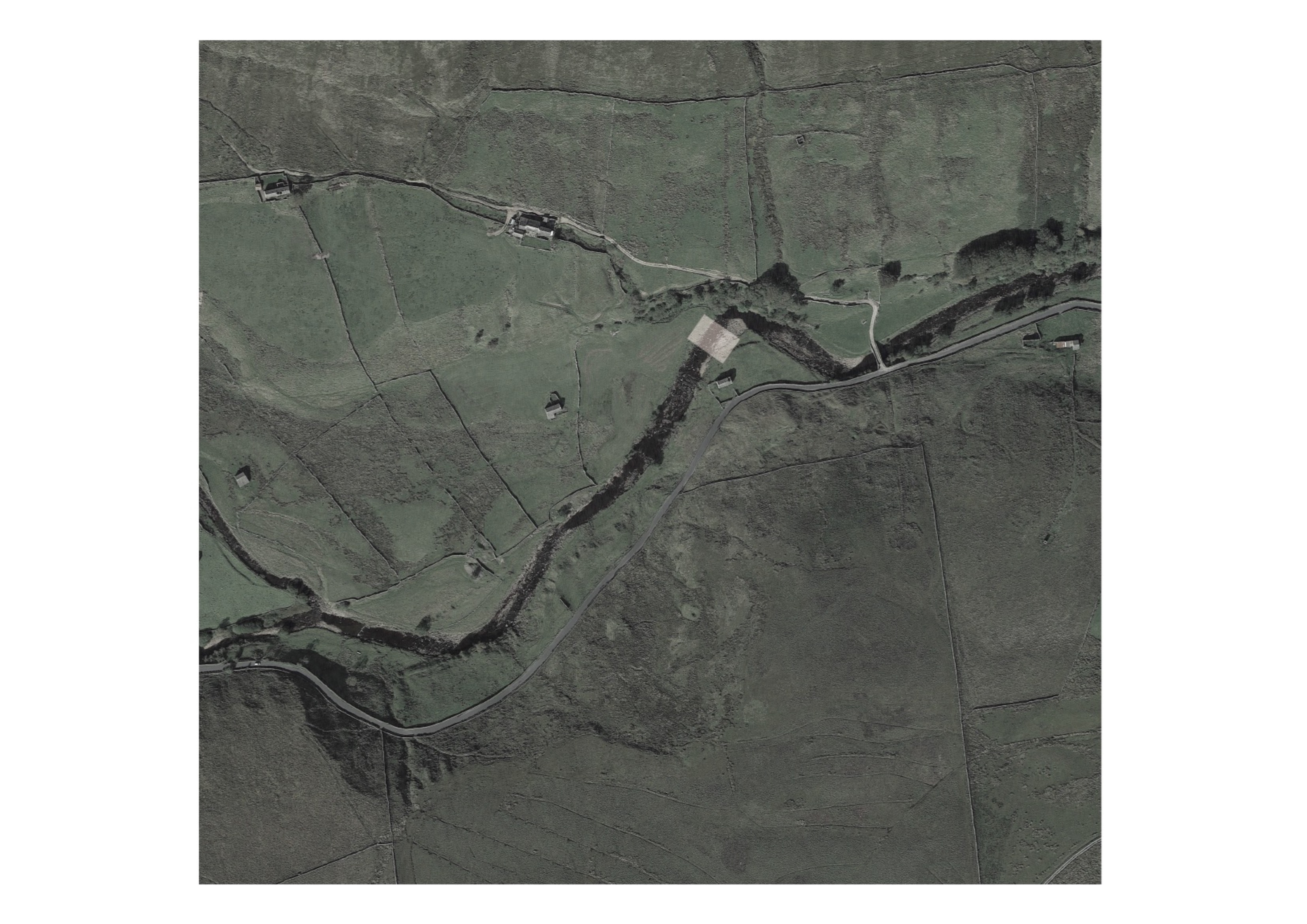
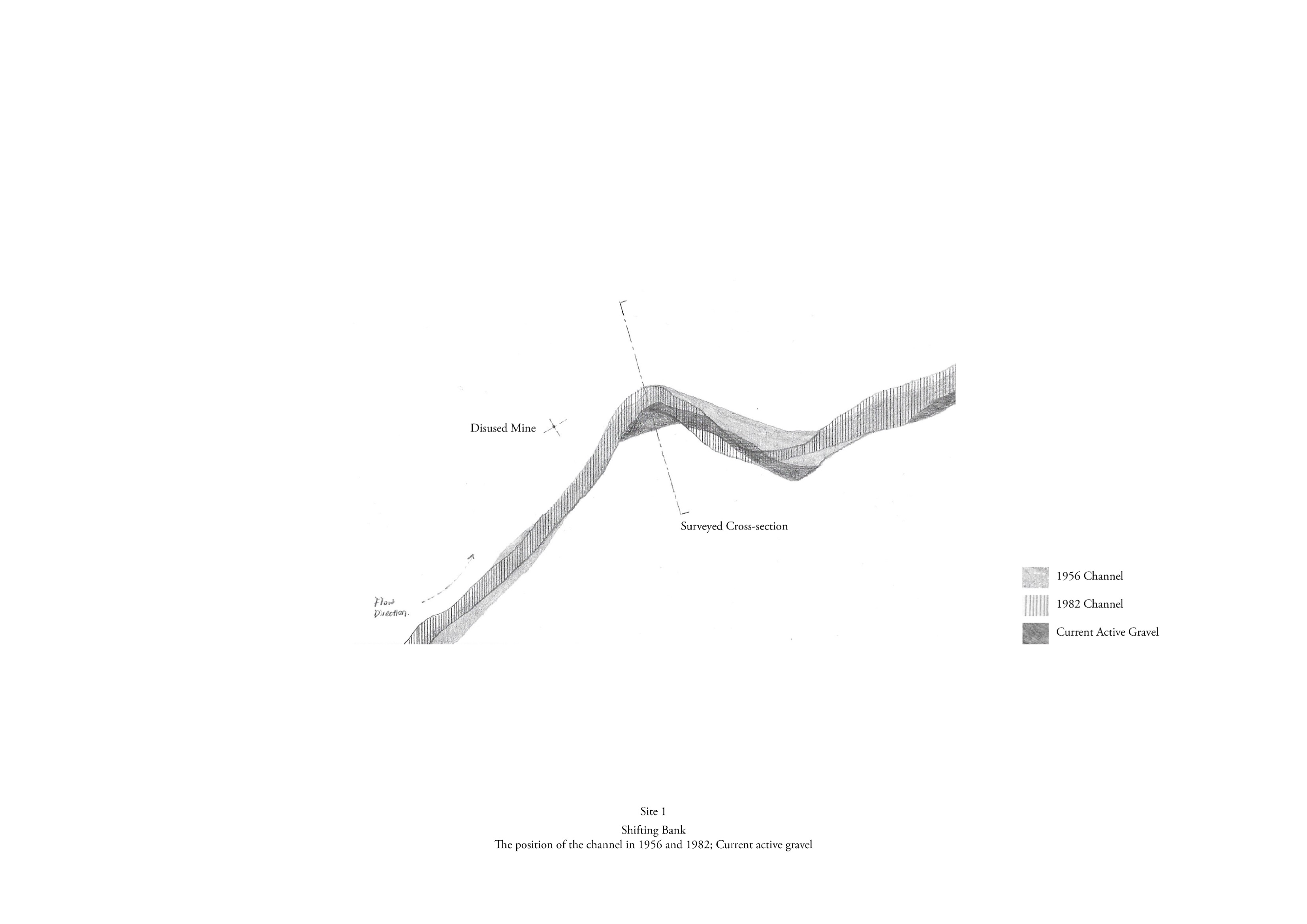
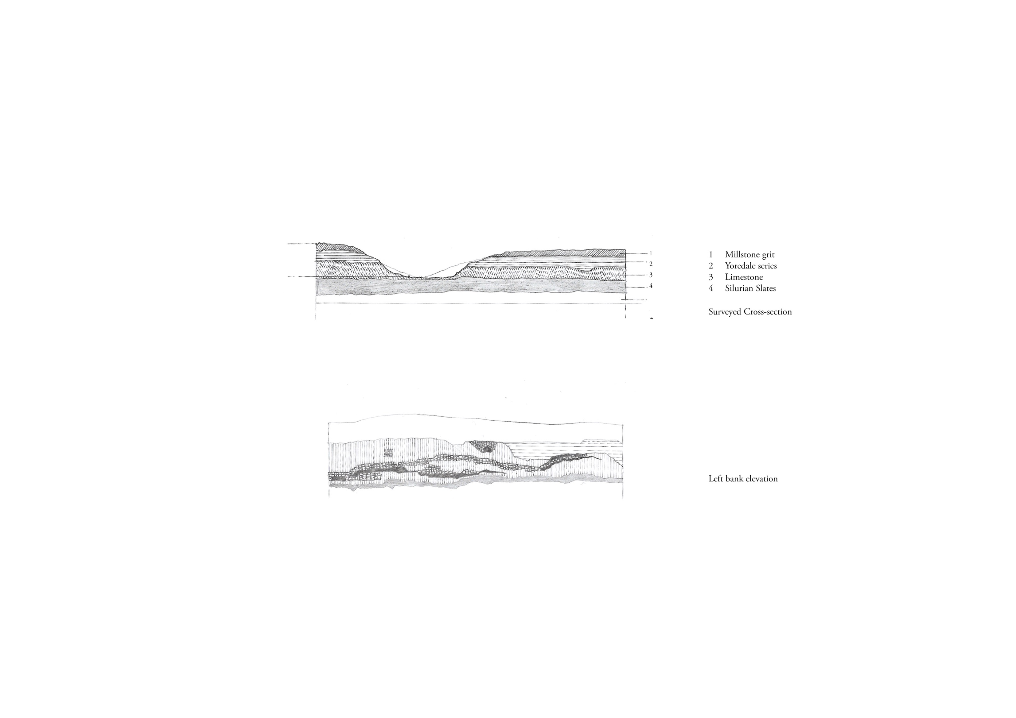
Site 1 is right following the merger with other rivers and streams, on a short riverbank with exposed limestone and very mobile gravel, accelerating the river speed and increasing the bank erosion. Both banks are sheep-grazed grassland with disused mining heritage and neglected barns aside.
A temporary observatory for recording flooding level and speed. Using water as the source, transfer its kinetic energy into the intervention’s mechanical energy. People can get a more vital awareness of the flooding at the beginning of the river. It also serves as a resting cabin for hikers.
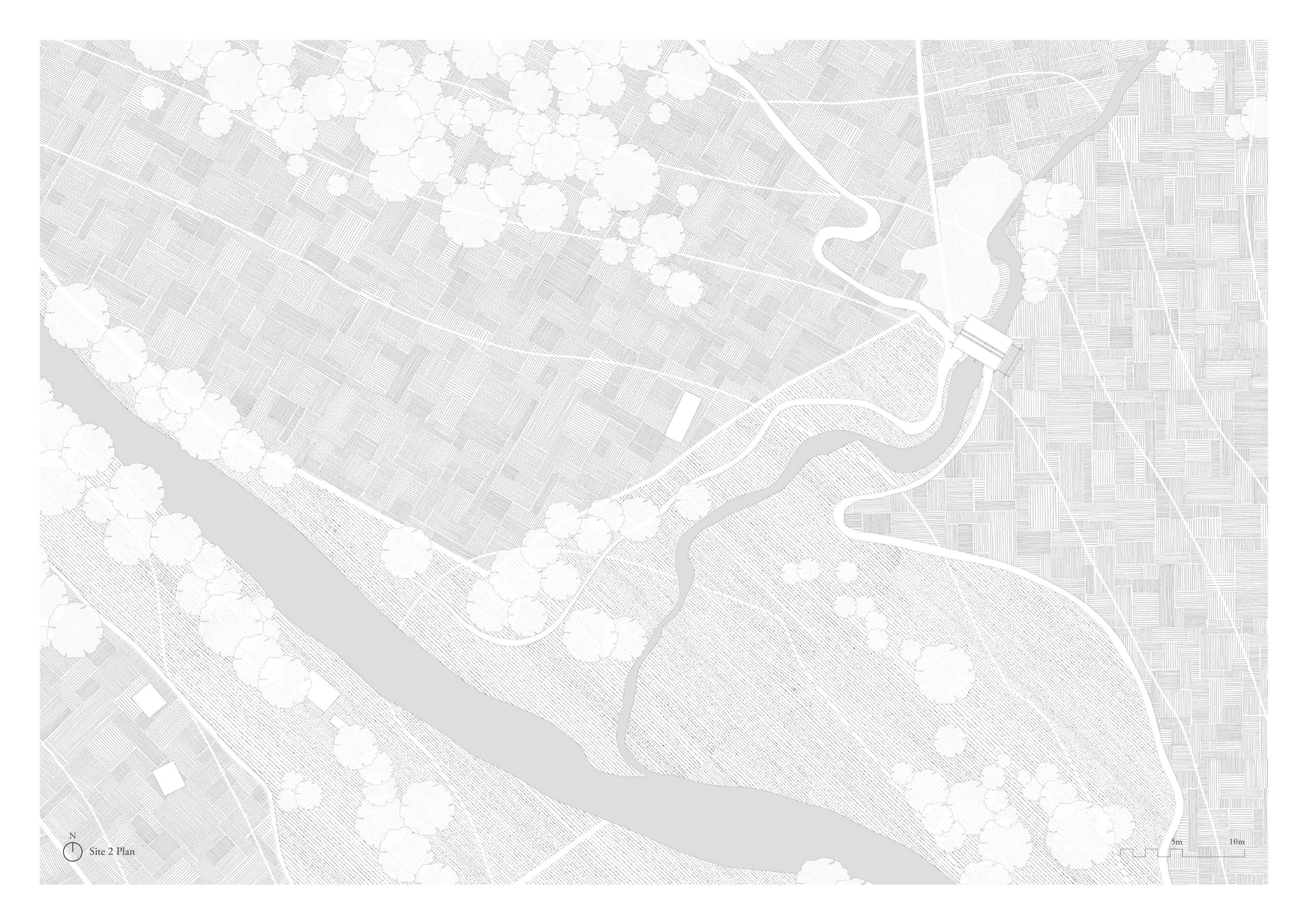
_ Site 2 Swinner Gill Complex

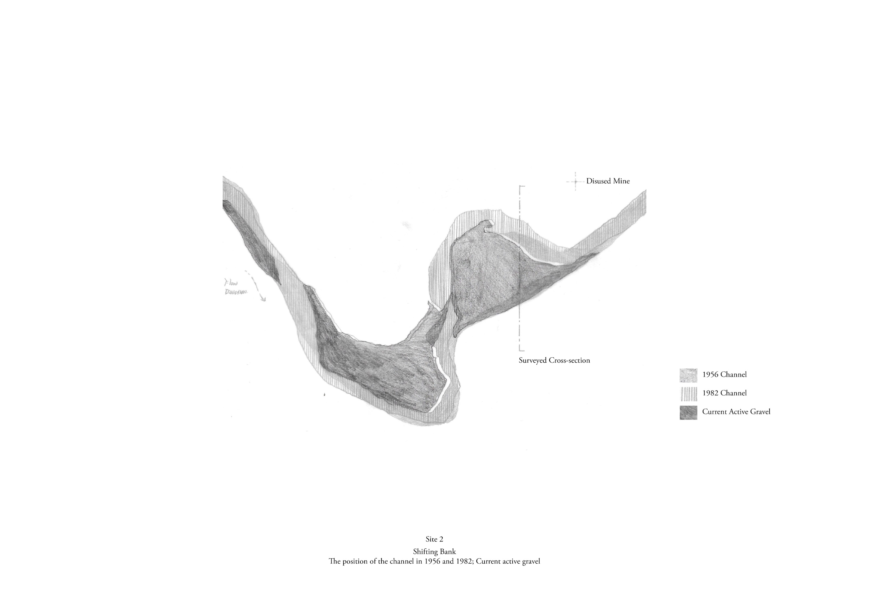
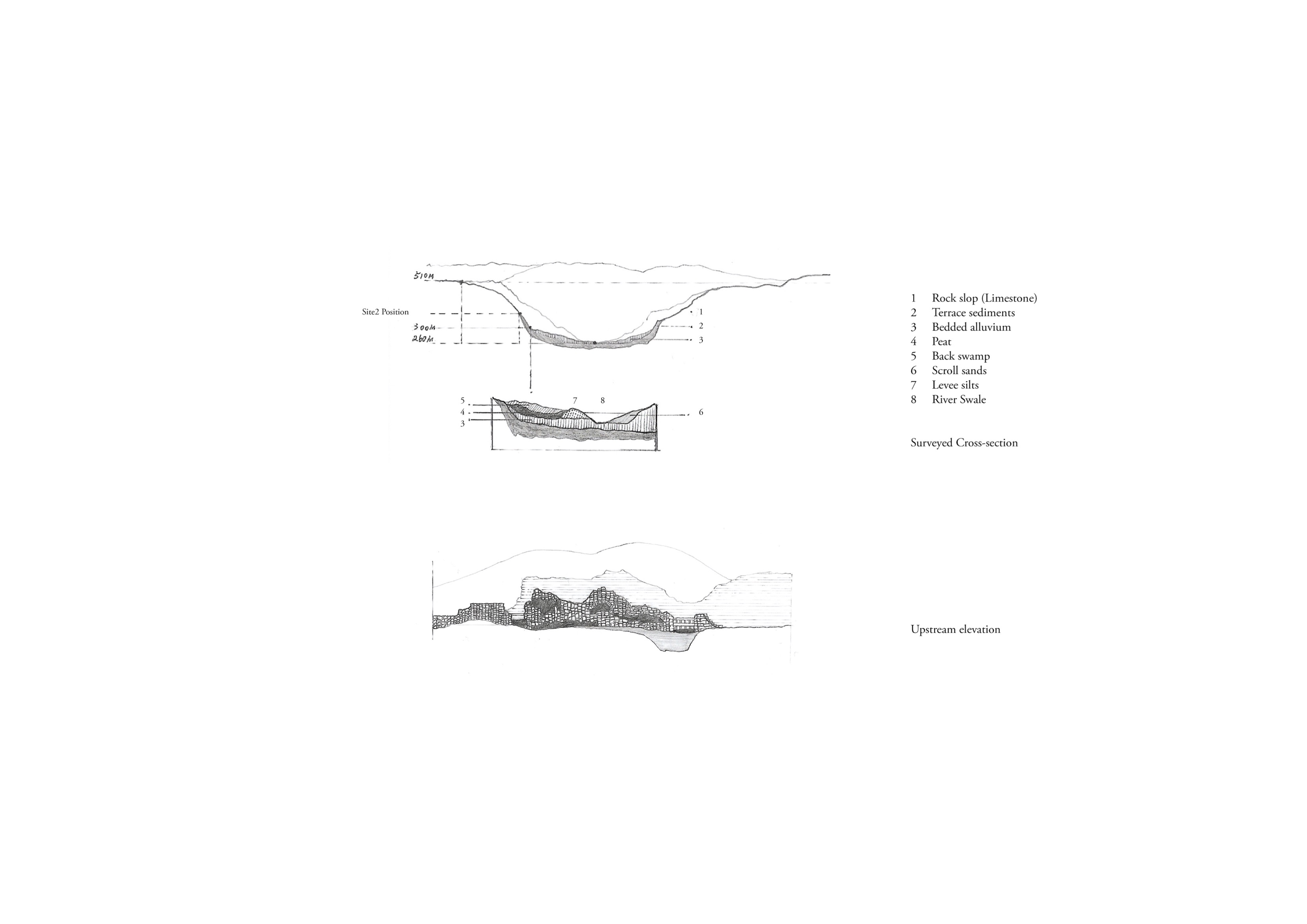
Site 2 is at the Swinner gill and river swale meeting point, which creates a huge eroded section and a flat alluvial plain. The old disused Beldi Hill Mill aside is partly flushed by the water.
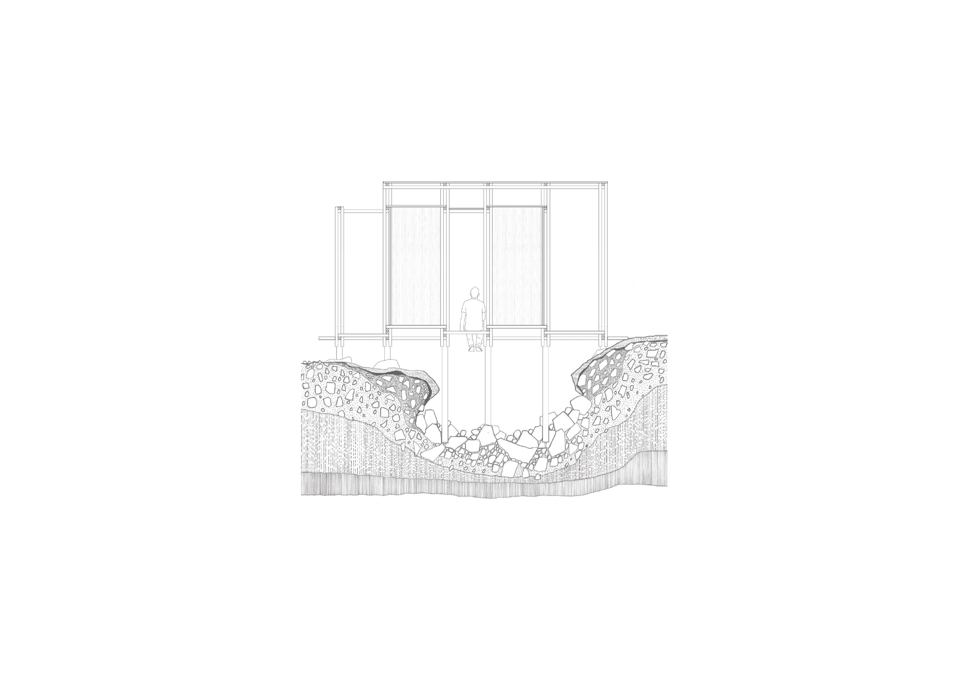
An intervention for framing the decay of the landscape with both banks and mining heritages.
It’s also a flexible bridge above the gill, connecting both sides of the waterfall. As time passed, the intervention would move with the eroded bank. Before crashing down, it will be dismantled, partly reused, and applied to other sites. When hikers walk through, the half-enclosed space partially blocks light, sound and view. A darker interior contrast with the opening towards the decay. They can sit inside the bridge, feel the water flowing beneath and stare at the landscape.

_ Site 3 Gunnerside Complex
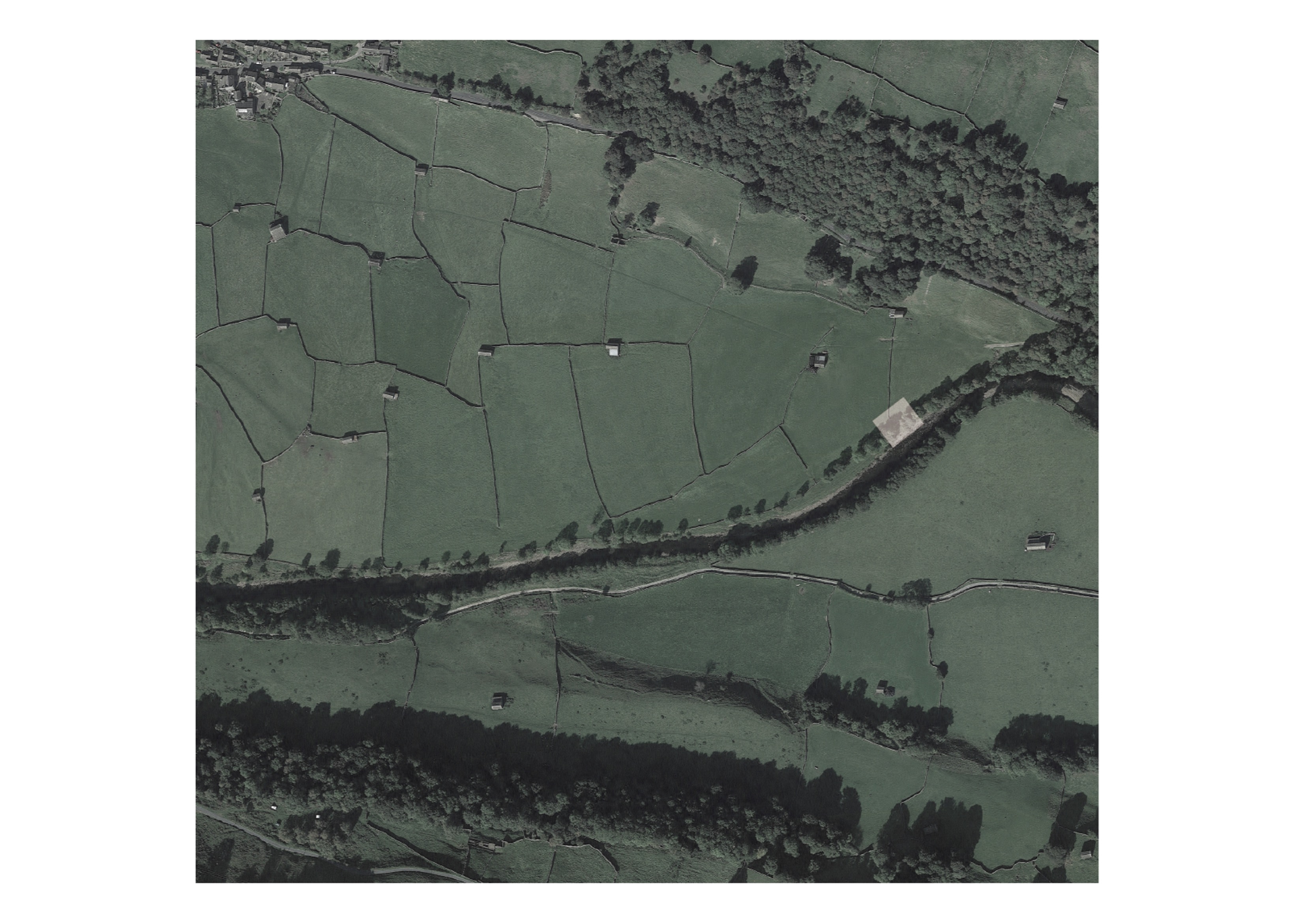
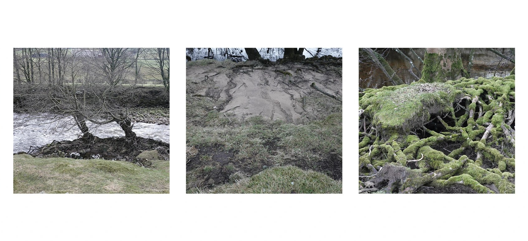
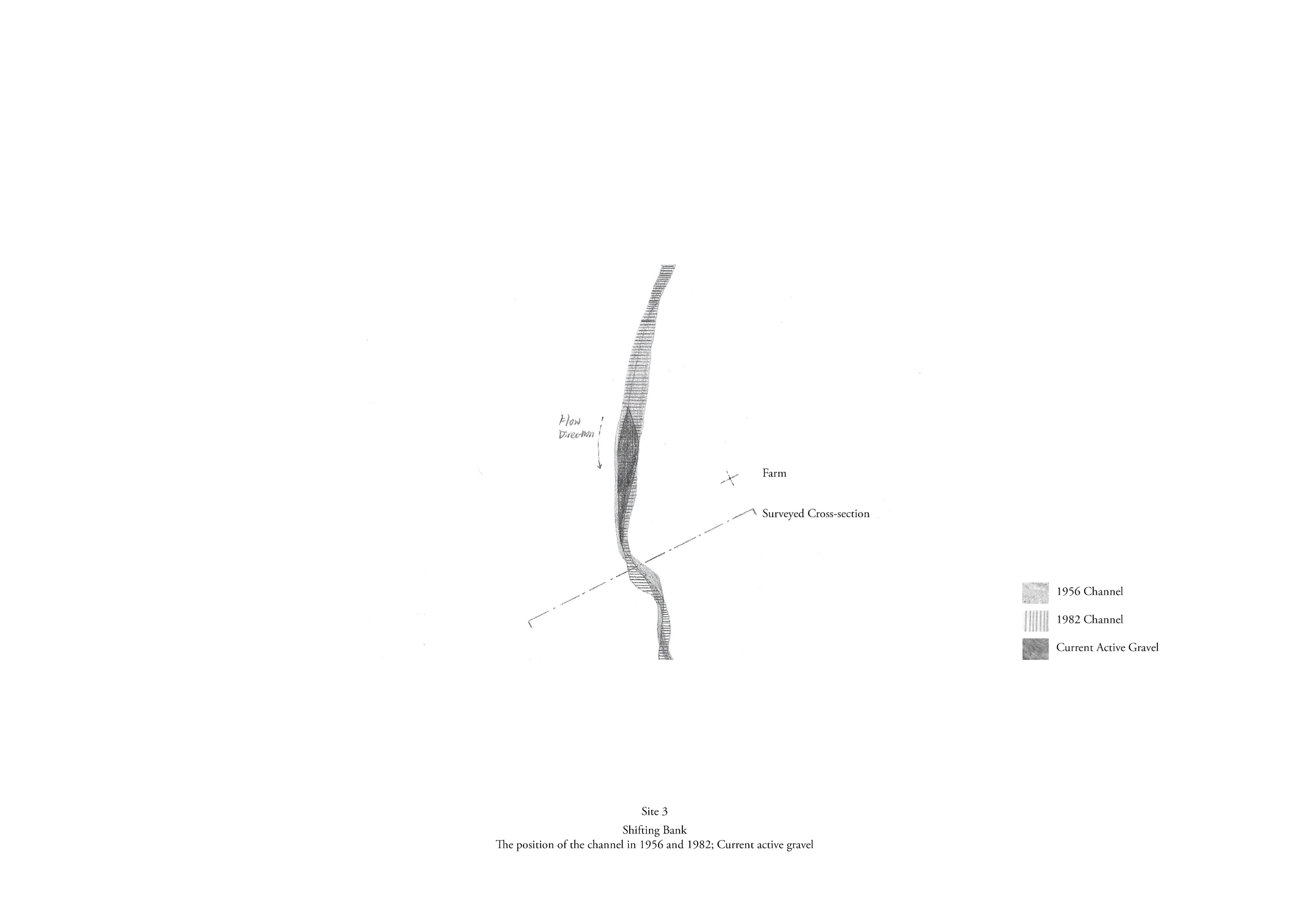
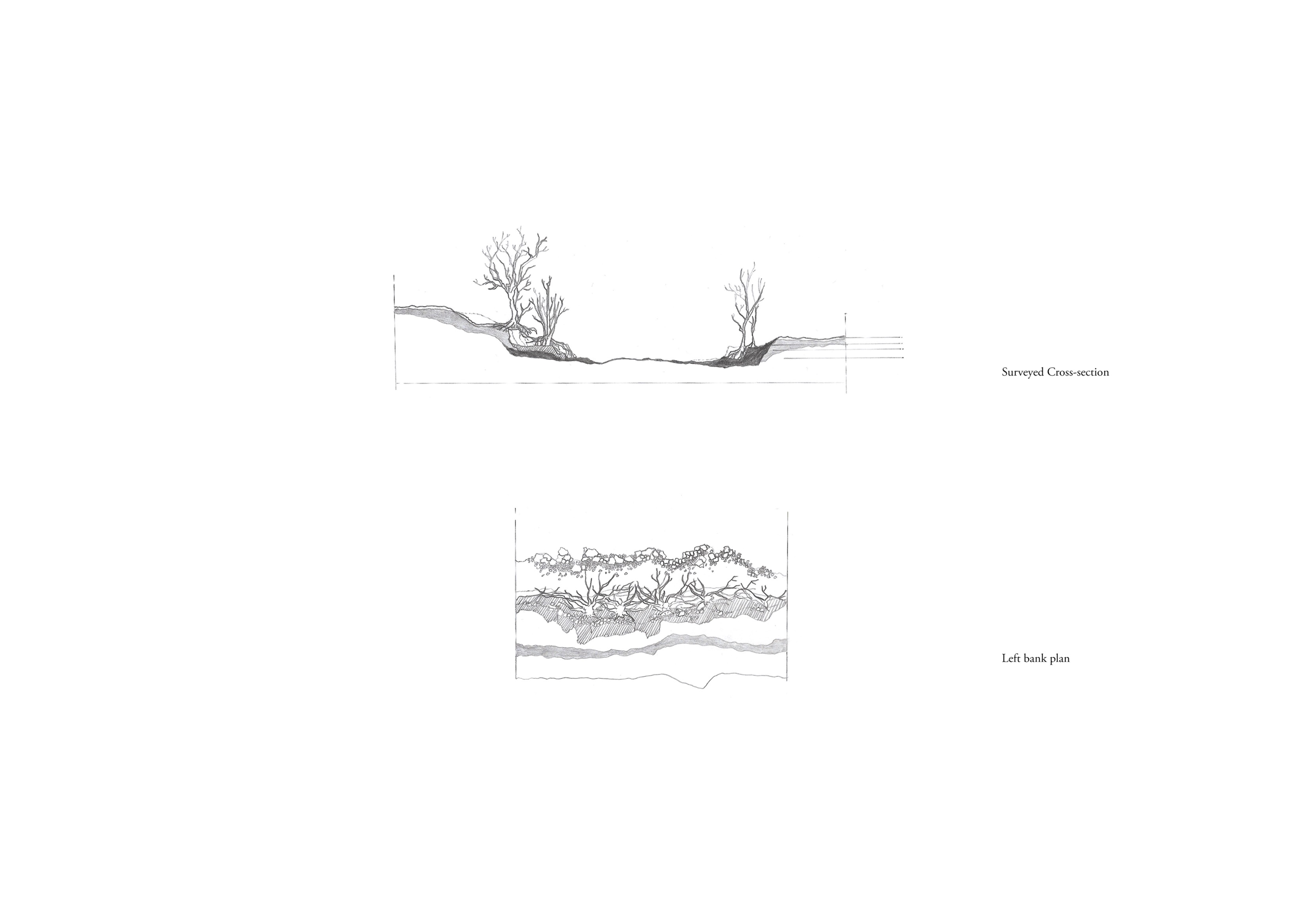
Site 3 is on the way, passing the dense woods from Gunnerside to downstream. The river is relatively narrow here, with farmland on both sides. A large part of the soil underneath the tree root has been washed away on the riverbank, leaving void spaces and creating many ground layers.
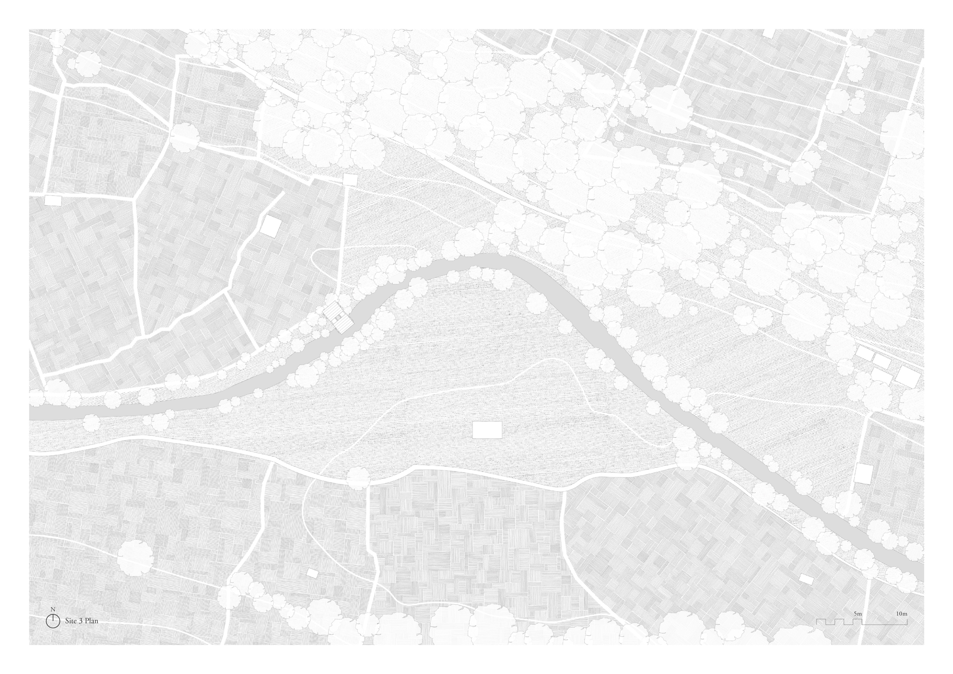

A temporary for zooming in the tree root and bank erosion underfoot.
The enclosed cabin creates a special acoustic effect for amplifying water sounds. The skylight also produces a unique atmosphere for sensing nature and meditation. As a temporary observatory, it can be easily constructed, deconstructed and moved to different spots along the river, touching various land conditions by applying different base designs.
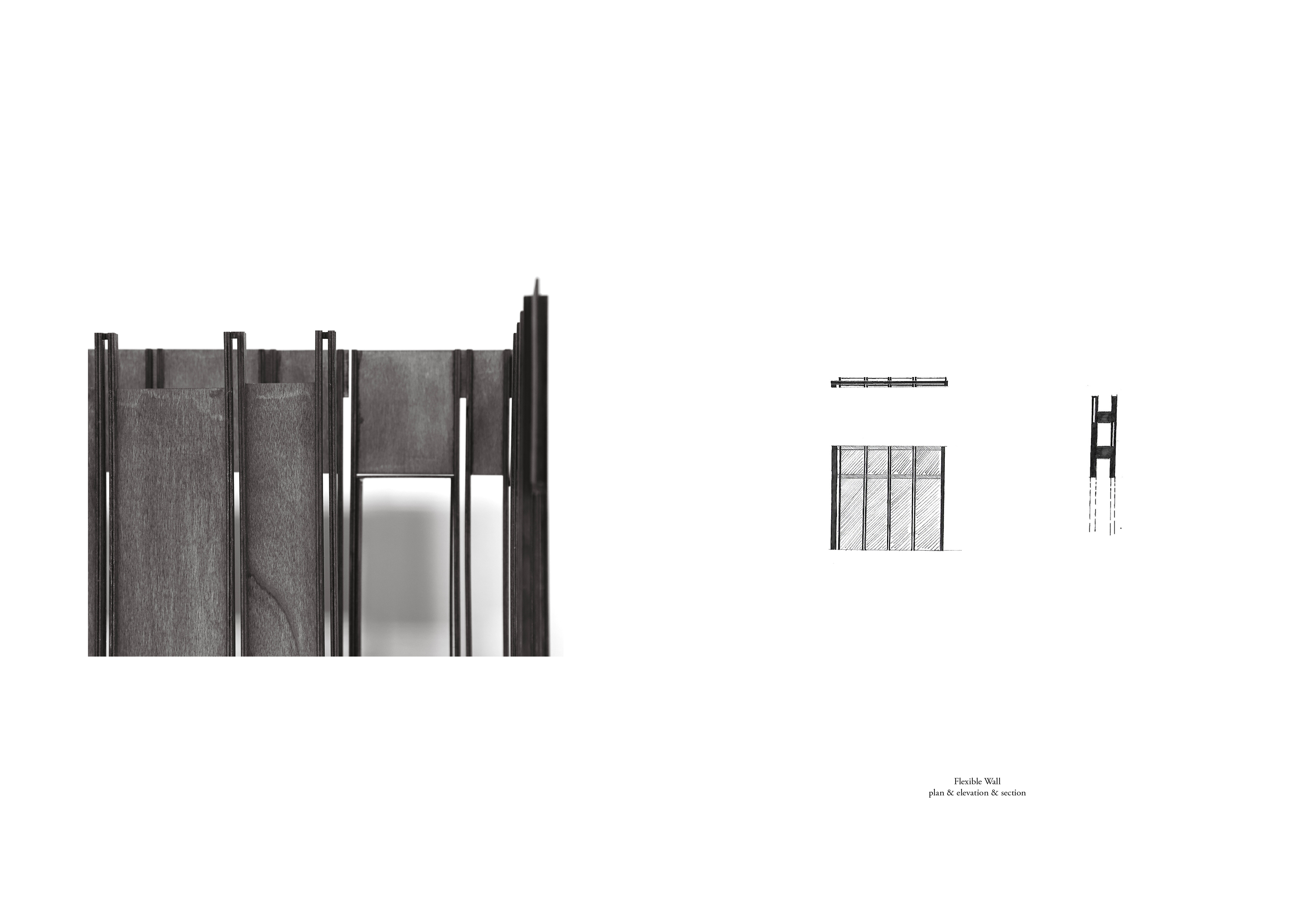
_ System